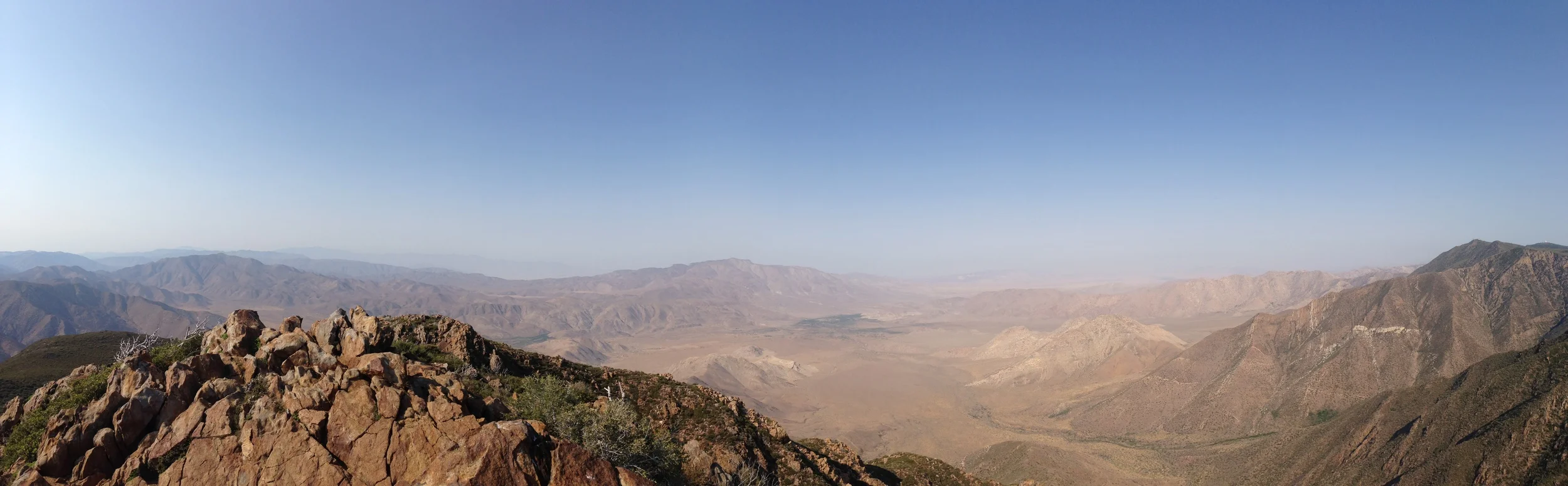
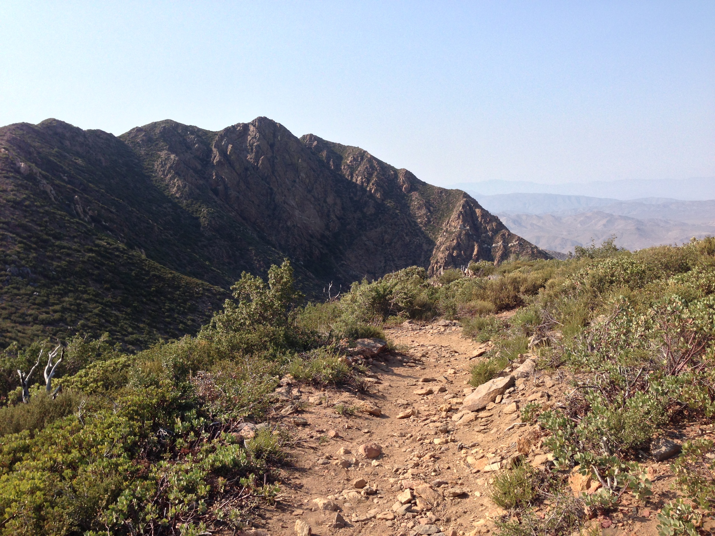
On July 5, 2013, I left work early, and headed up to Garnet Peak in the Cleveland National Forest to start my weekend with a short hike. It was a picture-perfect day with blue skies and since it was Friday afternoon, there was absolutely no one on the trail. The only downside on that day was the weather: it was hot , and the wind that rushed out of the Anza-Borrego Desert felt like an open oven. I remember feeling some of the plants and they were dry . Everything was tinder dry - not good for July in San Diego, where fire season lasts until October, or even November in drought years. Since I couldn't make it rain for the plants, I did the only thing I could: appreciated the natural beauty around me. Although I didn't know it, I was probably the last hiker to hike that area before it burned (photos here). On July 6, 2013, what became known as the Chariot Fire started, and spread through that portion of the Cleveland National Forest due to those dry conditions and high winds.
This weekend, as part of my Denali2014 training, I went back up to Garnet Peak and Penny Pines to work on my acclimatization while jogging on the Pacific Coast Trail (PCT). Also, even though I knew it would make me a little sad, as this had been one of my favorite areas in San Diego County to hike and run at, I wanted to see what the fire had done. As I drove up the Sunrise Highway, I was happy to see that the Chariot Fire had not completely destroyed the area. However, once I reached mile marker 23 on the highway, I could see what the fire had done and where it had burned, and you can too in the photos below. In order, the pictures range from a shot I took on July 5, 2013 (pre-fire) to several shots taken yesterday, September 8, 2013.
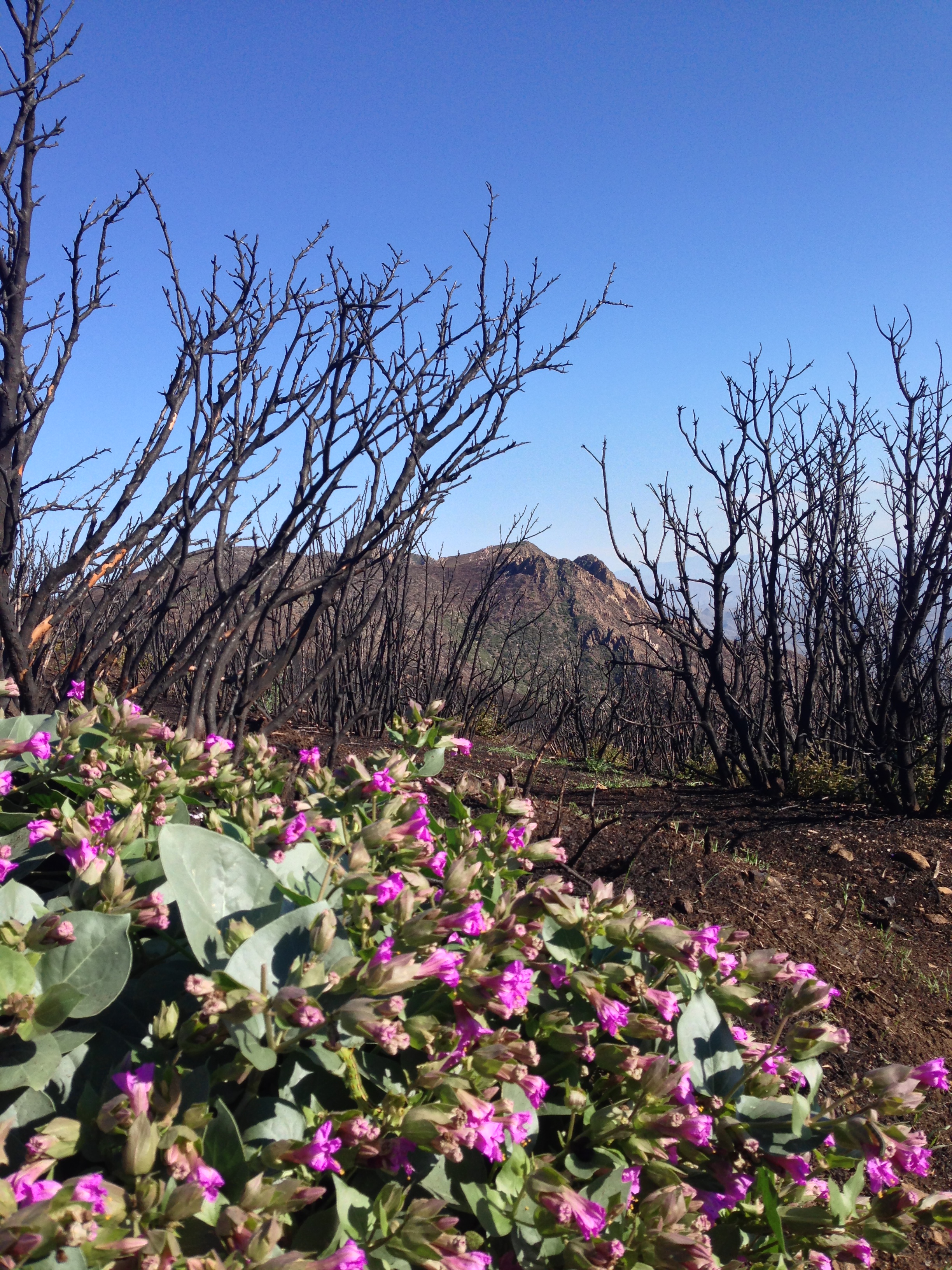
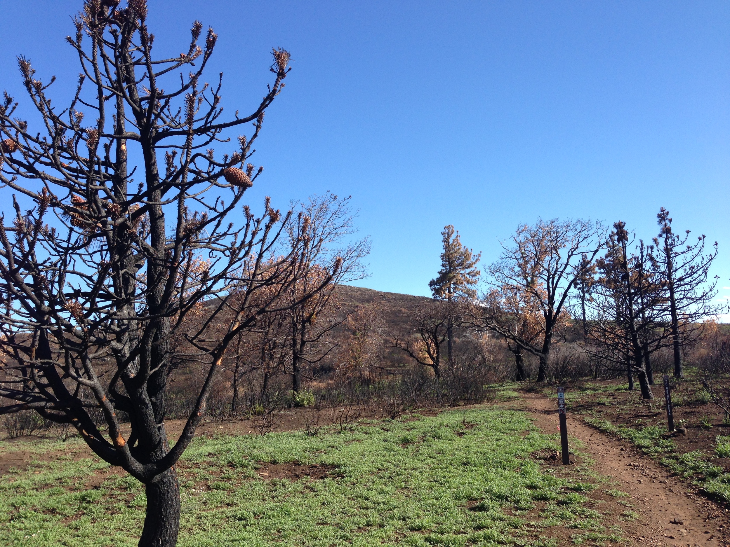
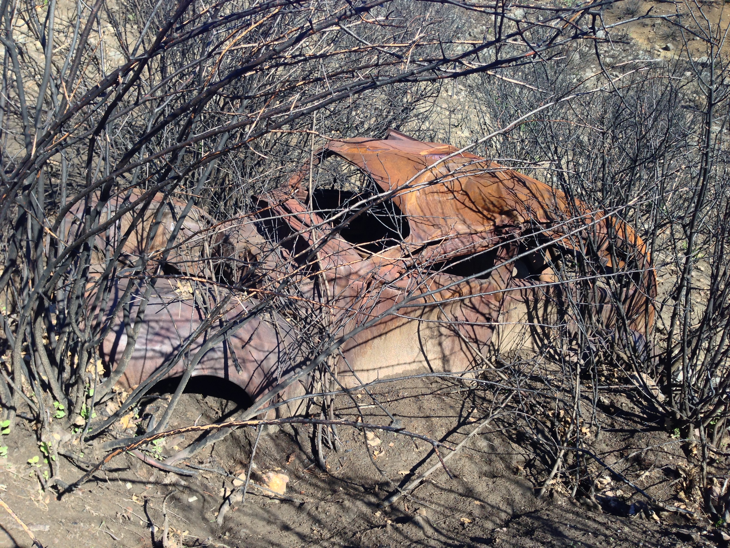
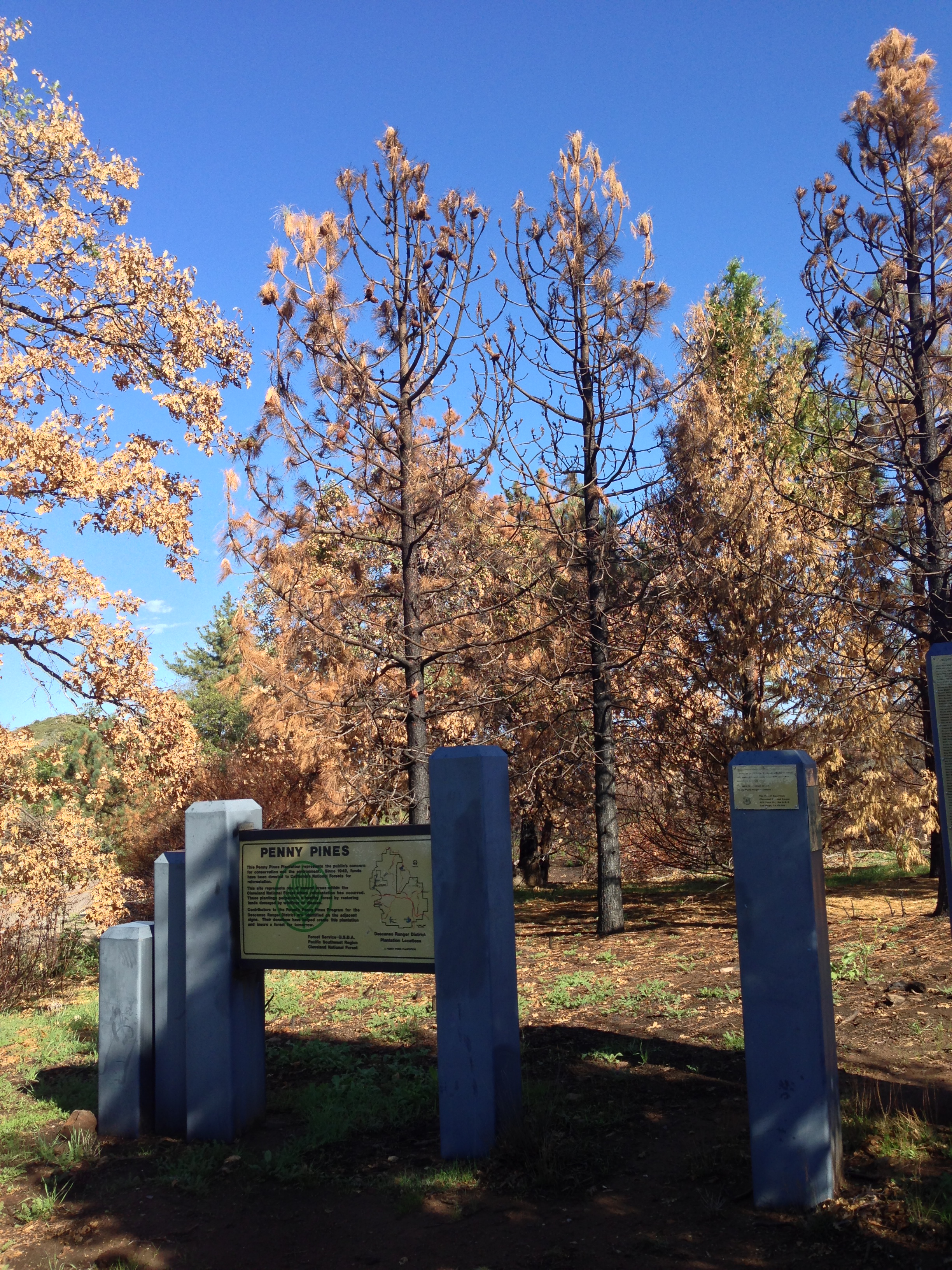
What I can say is this: fire is a natural part of any ecosystem; even if it's a personal favorite ecosystem of yours. Also, as long as I'm trying to be positive, parts of this area burned in 2003, so no old growth trees were lost in those spots. But, on the negative side, other parts burned that did not burn in 2003; and it is always a loss when these pristine areas do burn as it does take a while to recover. But, while I smelled and saw devastation everywhere along my run, what I also smelt and saw was green in new growth that is springing from the ash. Yes, the area won't be what it used to be for a while, but it will be back in the future. For more photos of the area before the fire, click here, here, and here, and for more shots of the area, check out my Denali 2014 training log below.

Argh! The video should end with this comment, "that it will be operating at a higher elevation" - ran out of space on the old iPhone - that'll teach me to talk so much. Actually, it probably won't, but until then, I'll continue to post training logs as we approach Denali in 2014 - and yes, there will be more specific talks about acclimatization.