
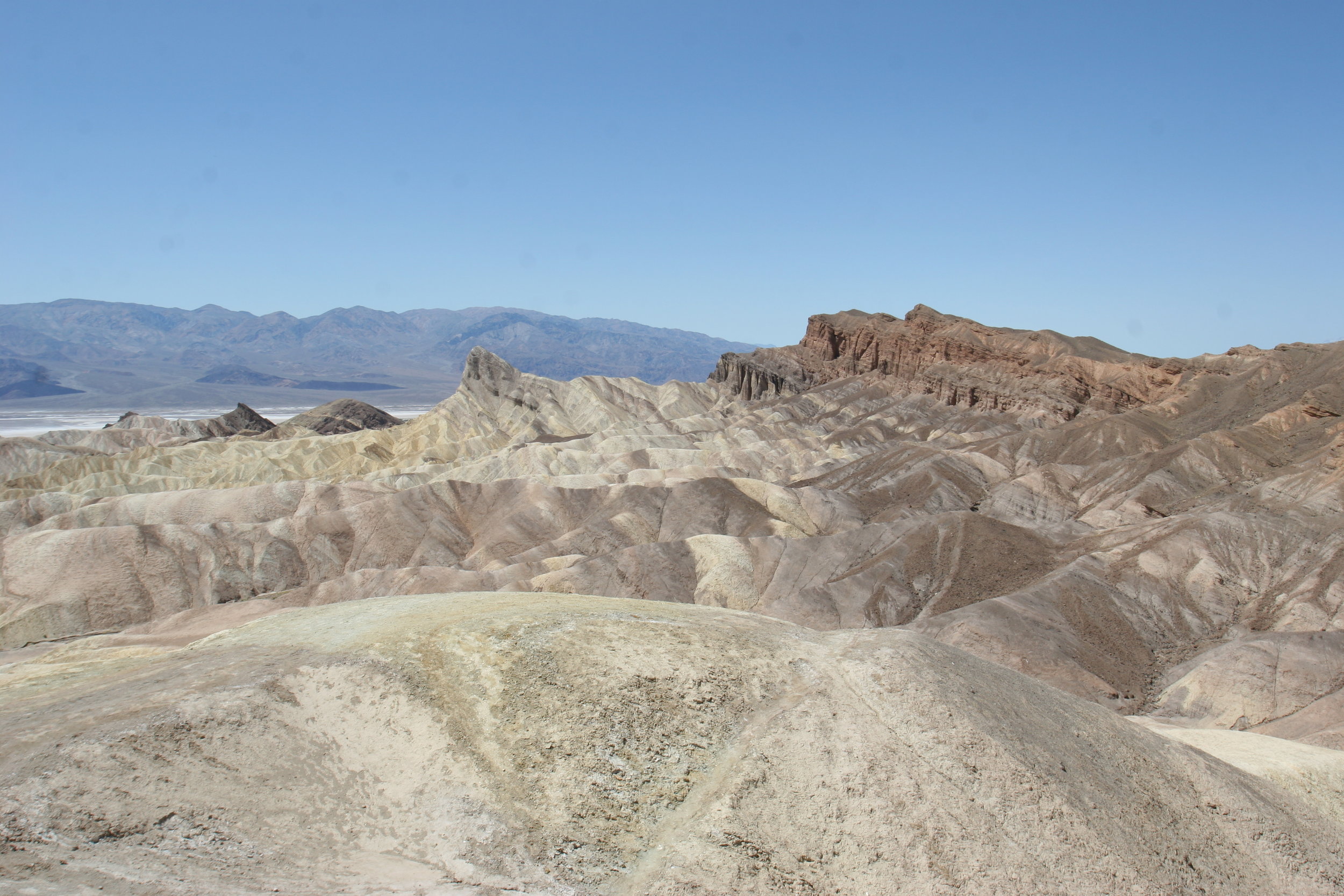
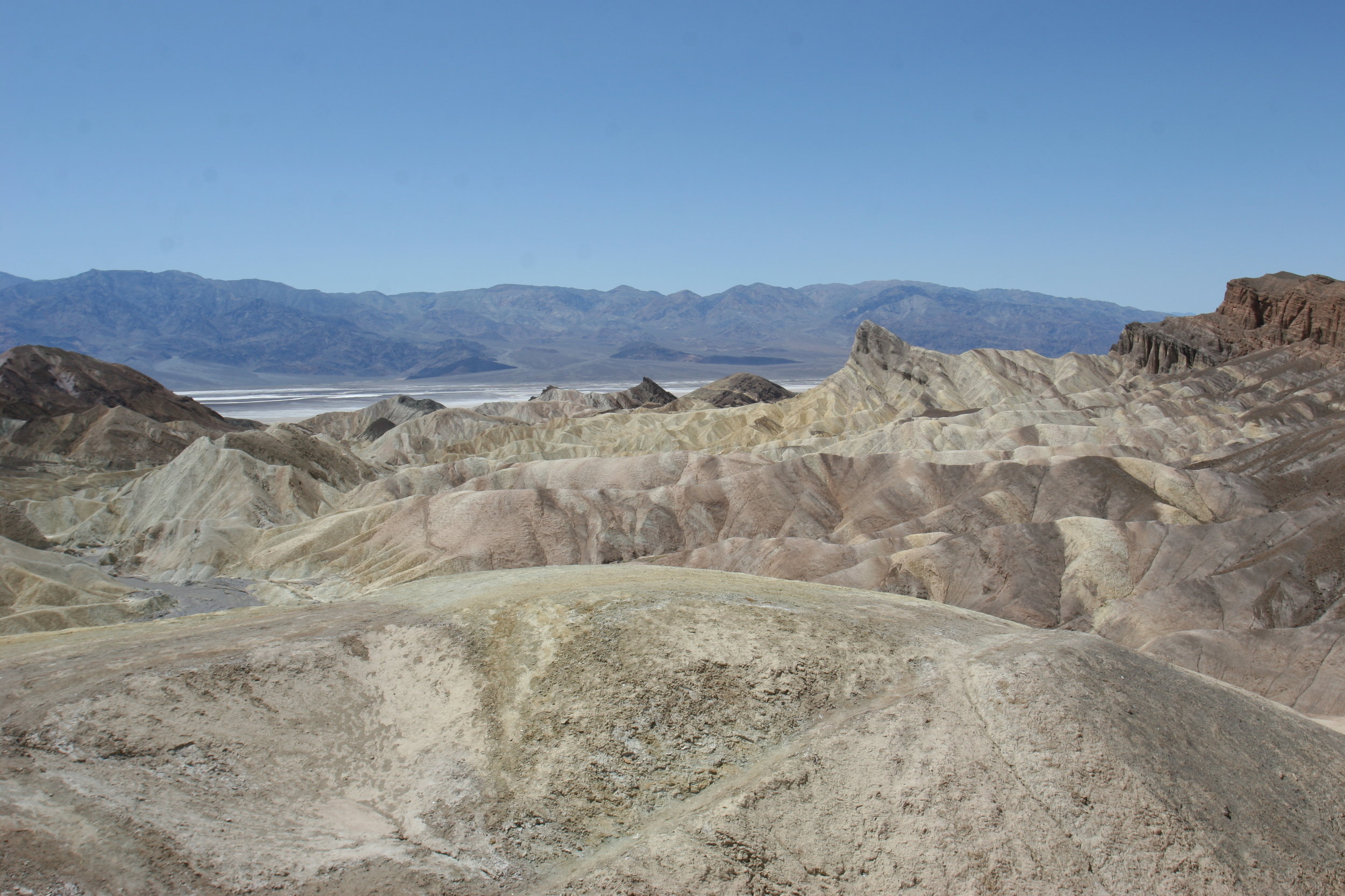
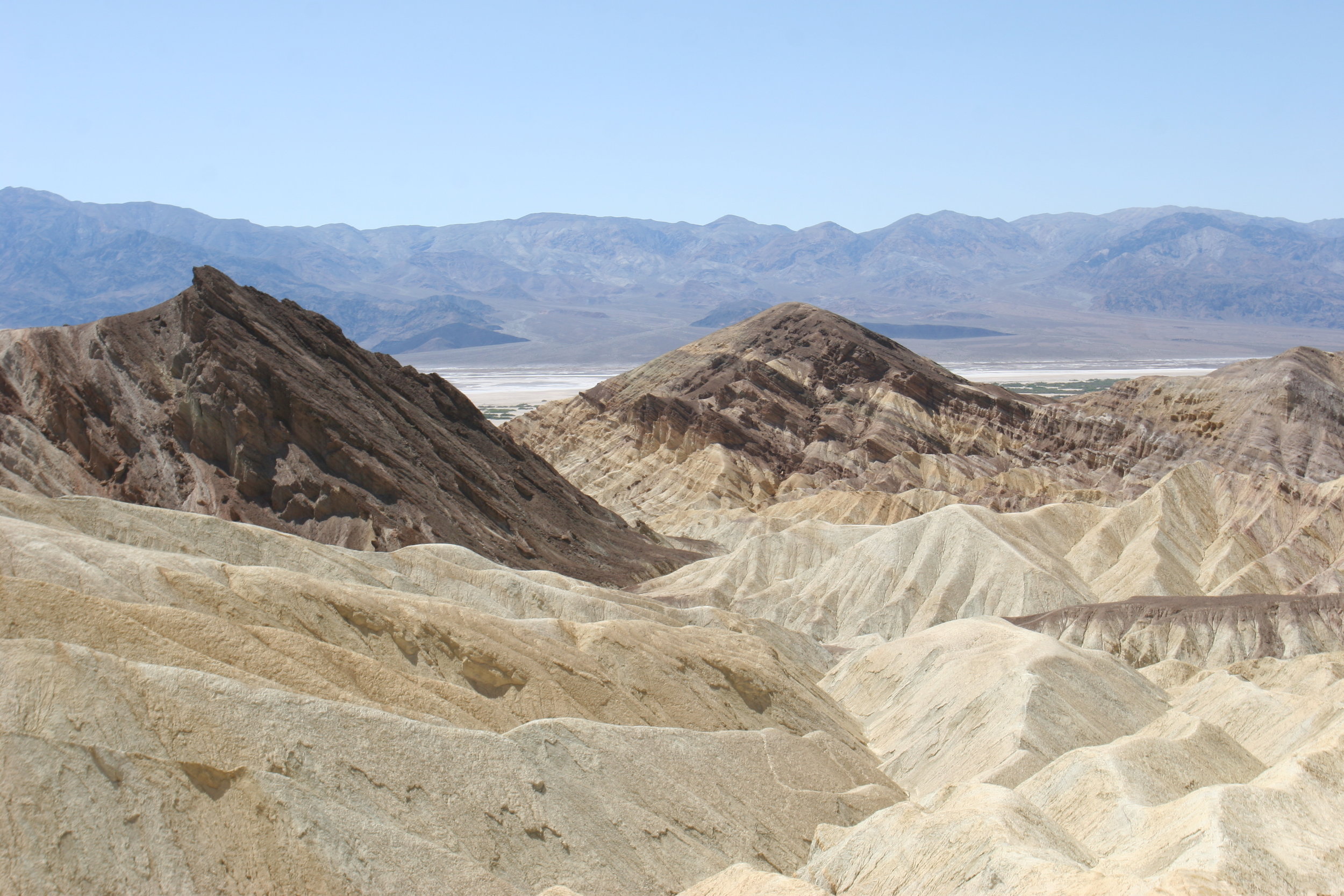
View from Zabriskie Point, Death Valley National Park
There’s a lot of hikes in the National Park system that get a lot of press as the “best hikes”. And, when I say “press”, I am not just talking about articles written by journalists and bloggers. I am talking about word-of-mouth hikes that are discussed between hikers and non-hikers; discussions that percolate world-wide about places that should be seen or, in some cases, depending on who is talking, have to be seen. A lot of these hikes deserve the reputation and the discussion that they get; and a lot of these hikes don’t deserve the reputation that they get. I’m not going to weigh in about which hike deserves what as it’s a matter of personal opinion in my book. What I will say, is that the best secret hike in the National Park system is the hike(s) I’m talking about here and last week: Golden Canyon.
It’s the best secret hike in the National Park system because not many people know about Death Valley. It just doesn’t have the cache of a Yellowstone, Yosemite, or Grand Canyon. Even people that know about Death Valley don’t talk about Death Valley. In this sense, knowing about Death Valley is like knowing about Fight Club. The first rule of Fight Club, and knowing about Death Valley is not to talk about it. It’s the best secret hike because of what you get to see: as I talked about last week, there’s amazing slot canyons to walk through and explore, there’s the Red Cathedral, there’s the Manly Beacon, there’s abandoned mines, and to top it all off, the reason the terrain is so spectacular is that you’re walking in an area that used to be a giant lake – Lake Manly. As an added bonus, this hike is full of opportunities to explore. Many times, on many trails, you are left with limited opportunities to see what else is out there. In Golden Canyon, there are ample places to wander off to and things to see. For these reasons, I rate it as the best hike in the National Park system that you’ve never heard of. So, if you like “best hikes”, this is a must-do in my book.
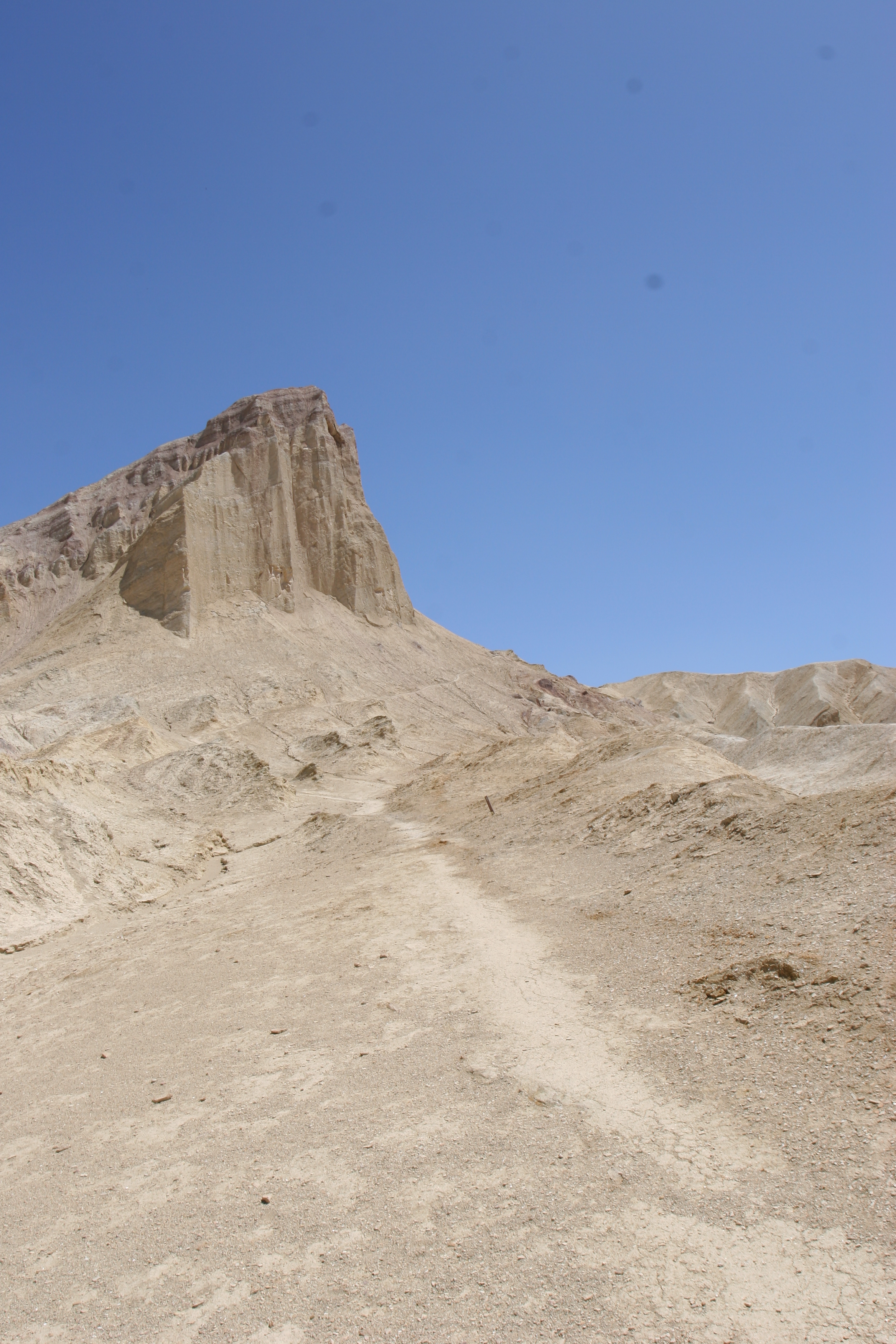
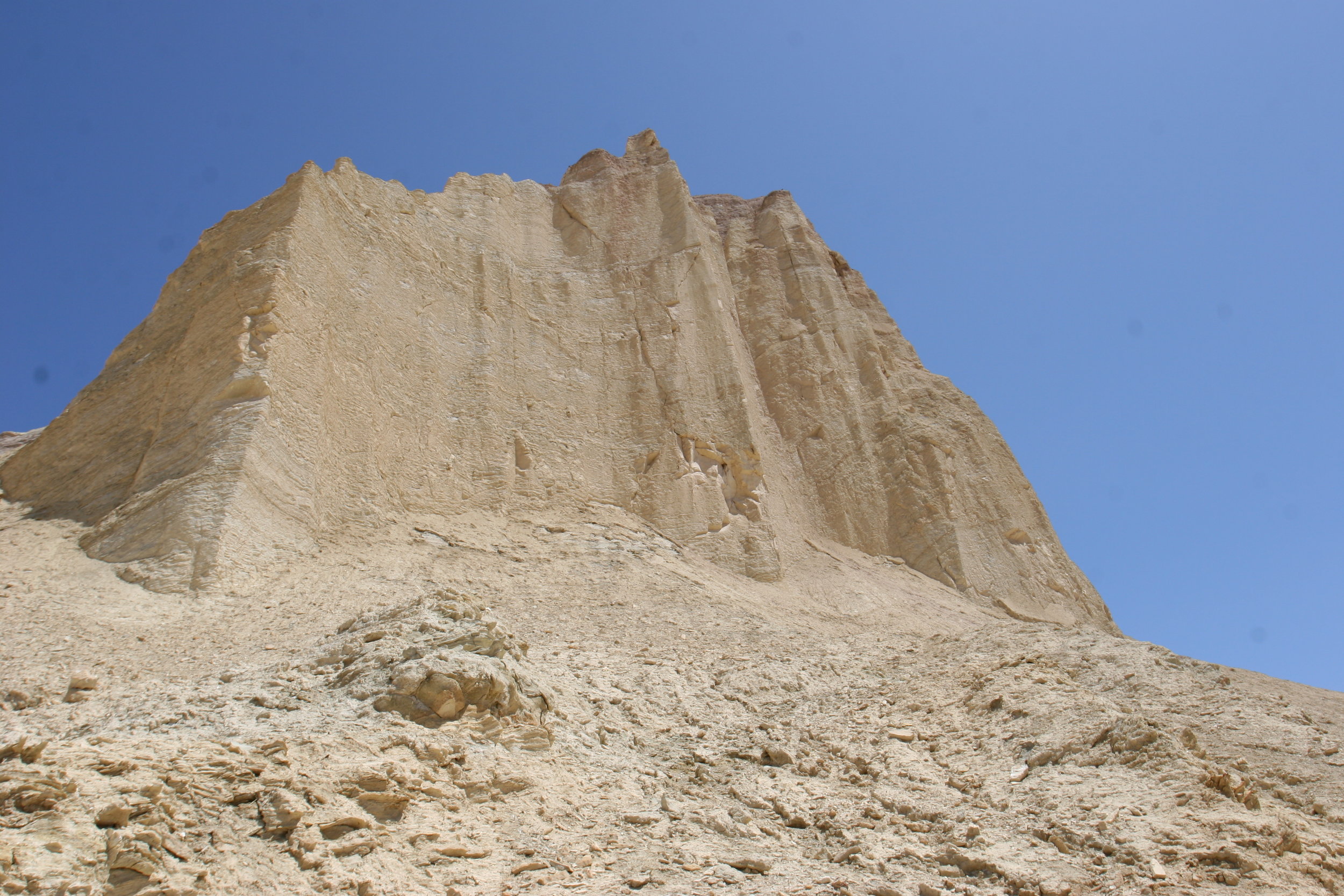
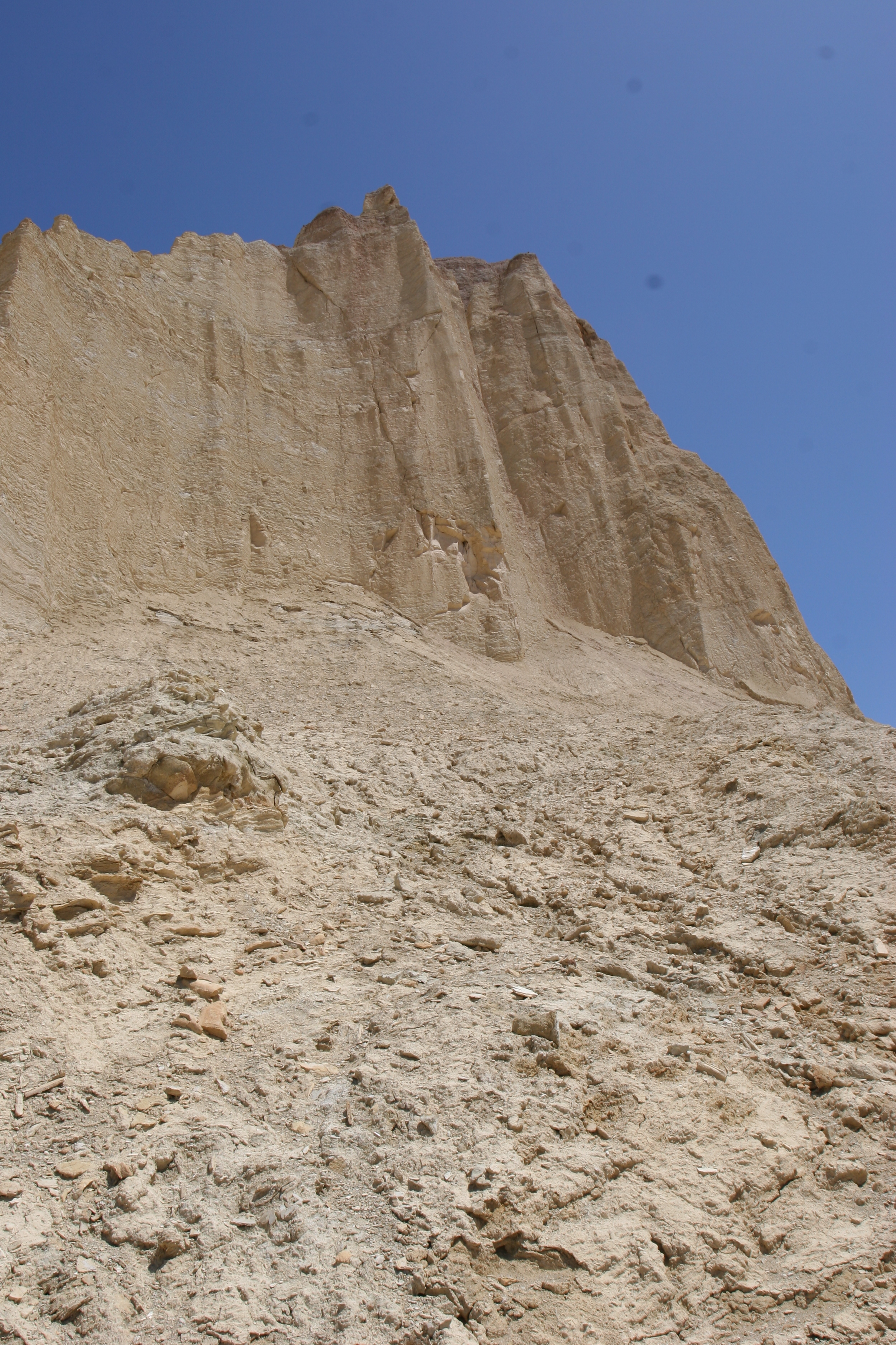
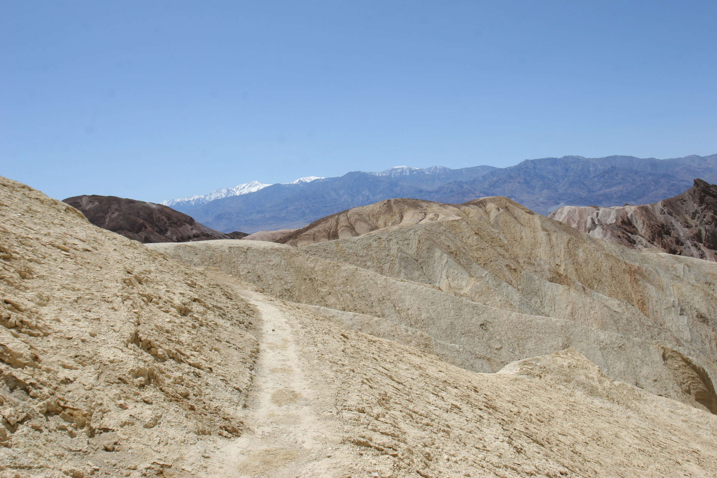
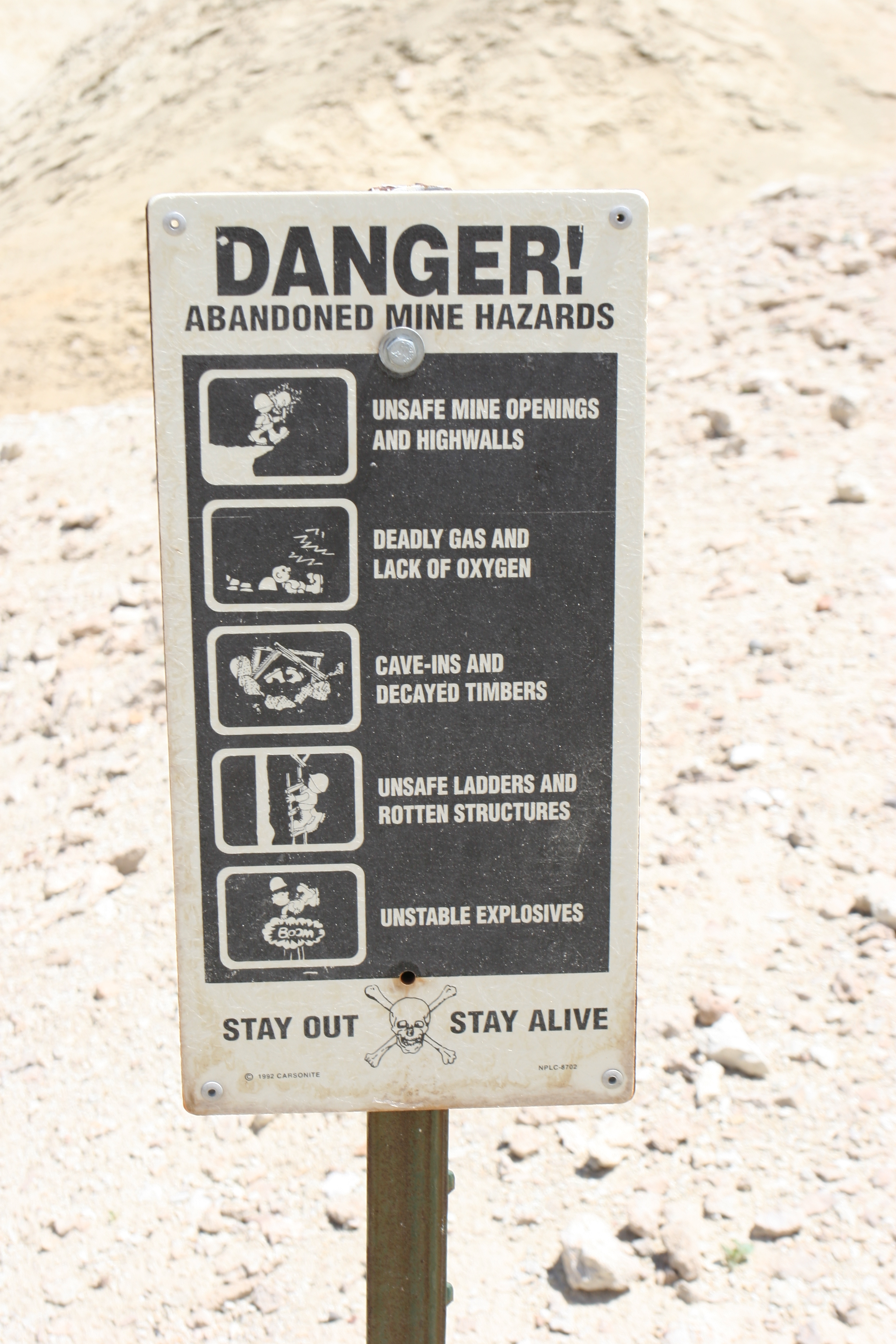
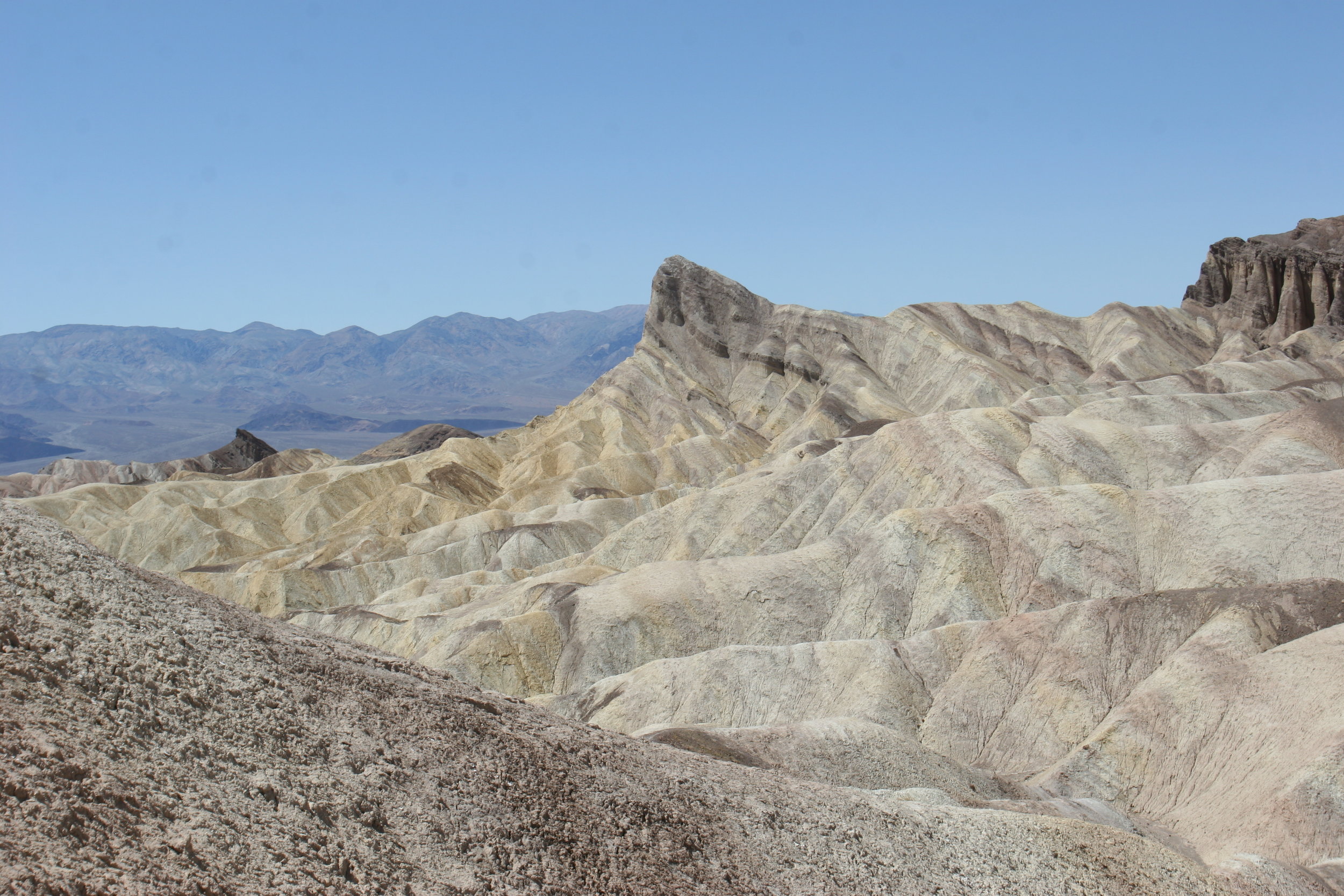
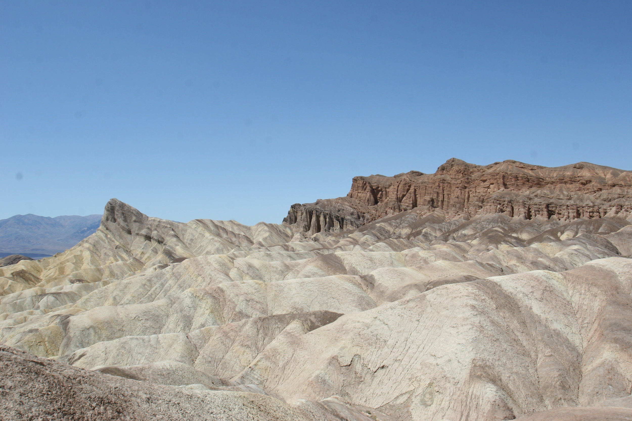
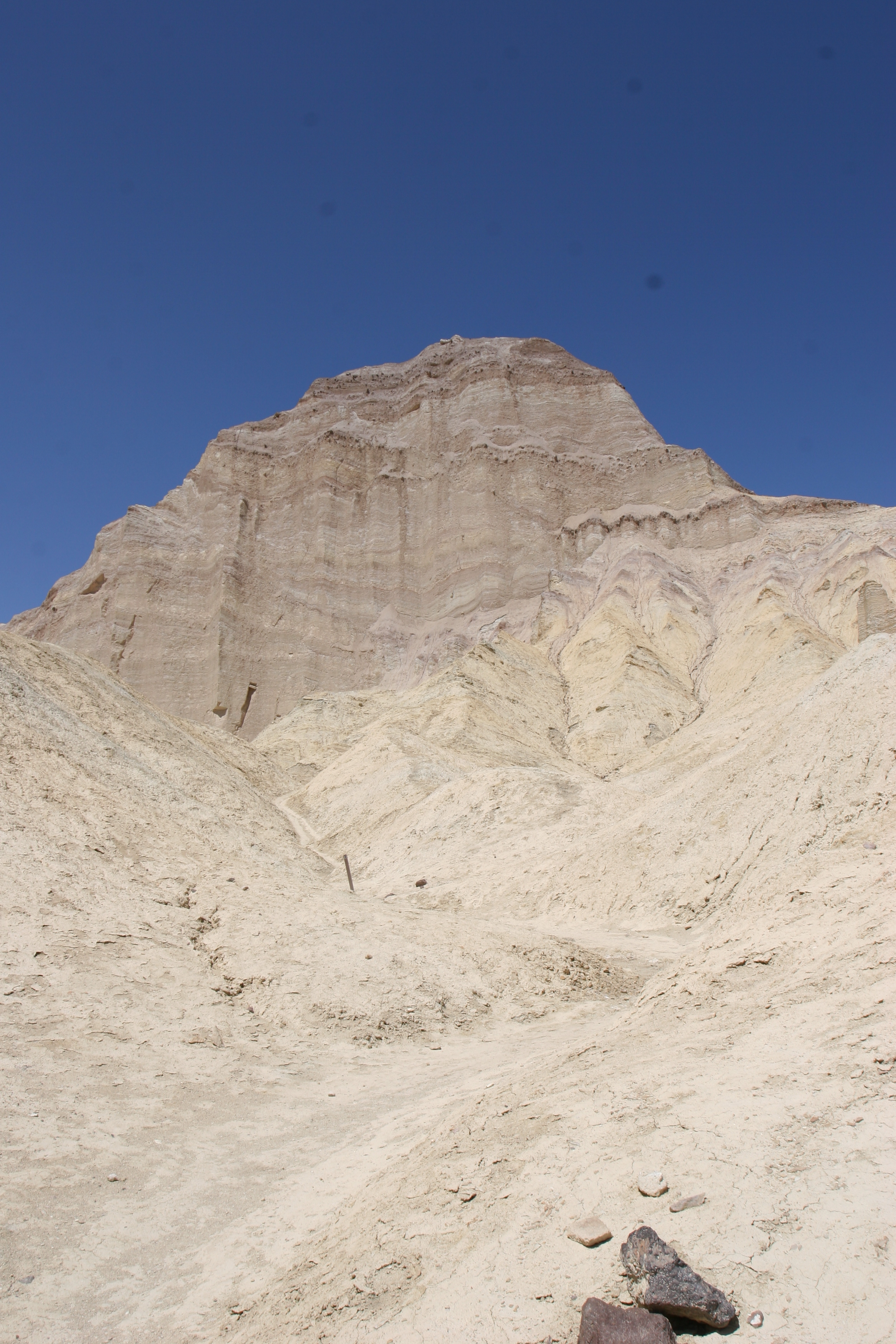
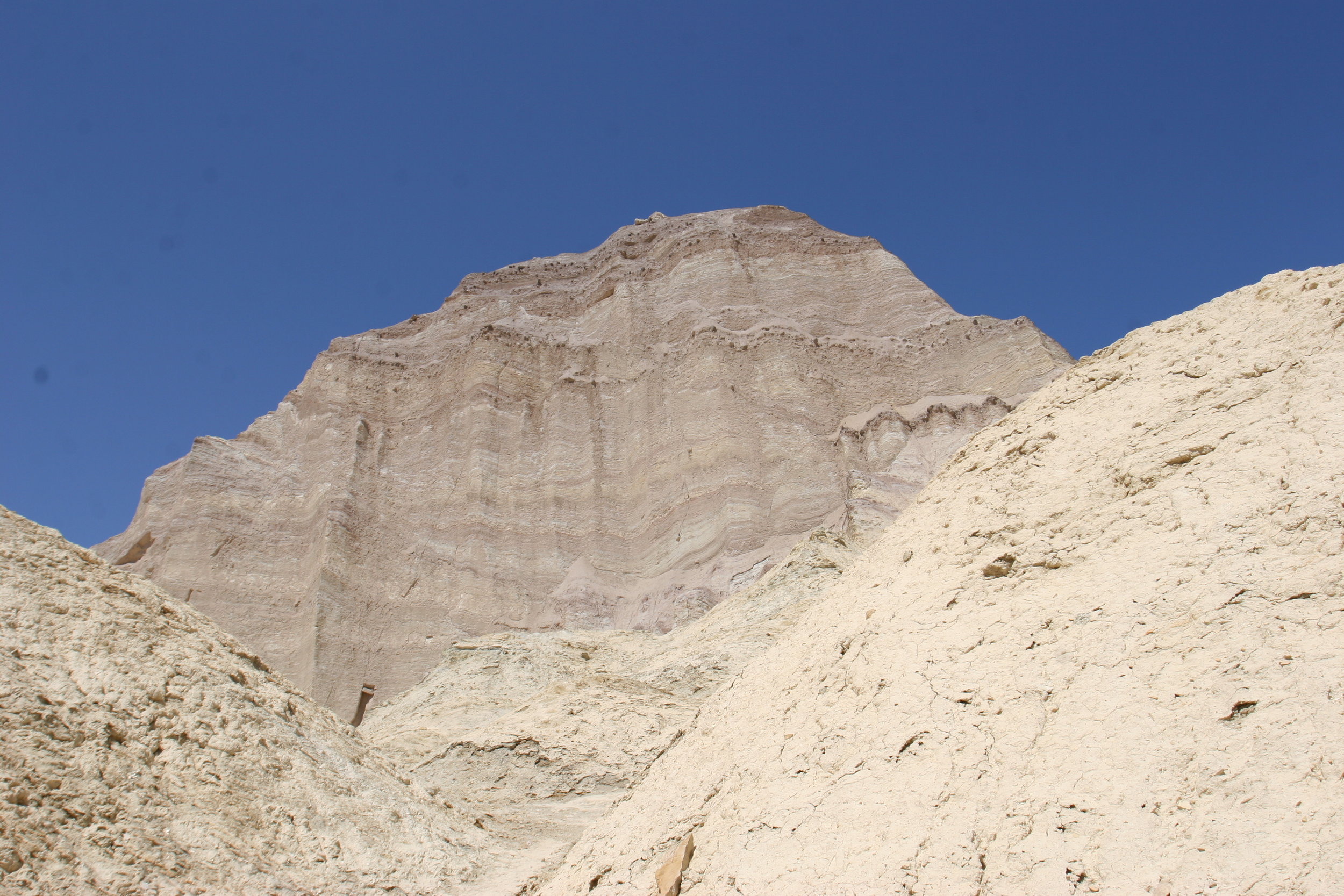
Directions: Follow the directions I discussed last week here to get to Golden Canyon. From Marker 10 of the trail discussed in that previous post, you can turn out to the Red Cathedral or continue on to Zabriskie Point. To get to Zabriskie Point, follow the signed turnoff, whereupon the trail will become markedly steeper for the next half mile (.5). To your immediate left (North) will be the Manly Beacon, which you will eventually pass before heading down into a series of gulches before heading up again toward Zabriskie Point. At around three quarters of a mile from the turnoff (.75), there will be a number of mines that you can peer into before continuing toward Zabriskie Point. It is worth noting that through this stretch of trail, the trail is not well marked, in that there are not many signs, and there are a few areas to navigate where if you are not familiar with the area, you could get momentarily lost.
However, this area is well worn by the soles of many hikers, and one should be able to follow the worn trail in areas where there are not trail markers. While I don’t generally recommend following foot trails blindly, this is an area where you should not get lost; and if, in the worst case scenario, you are not carrying a map and do get lost, I recommend that you climb to a high point (of which there are plenty) in this region, and look either East, whereupon you will see the highest point: Zabriskie Point which you then can head to. Once you reach a wash at one mile past Marker 10 (2 miles from the Golden Canyon parking lot), you will see a sign directing you toward Gower Gulch or Zabriskie Point. At this point, you can either head back down Gower Gulch, and toward the Golden Canyon parking area, for a roundtrip distance of four miles (not counting diversions to the Red Cathedral); or you can head up the last half mile of trail to Zabriskie Point.
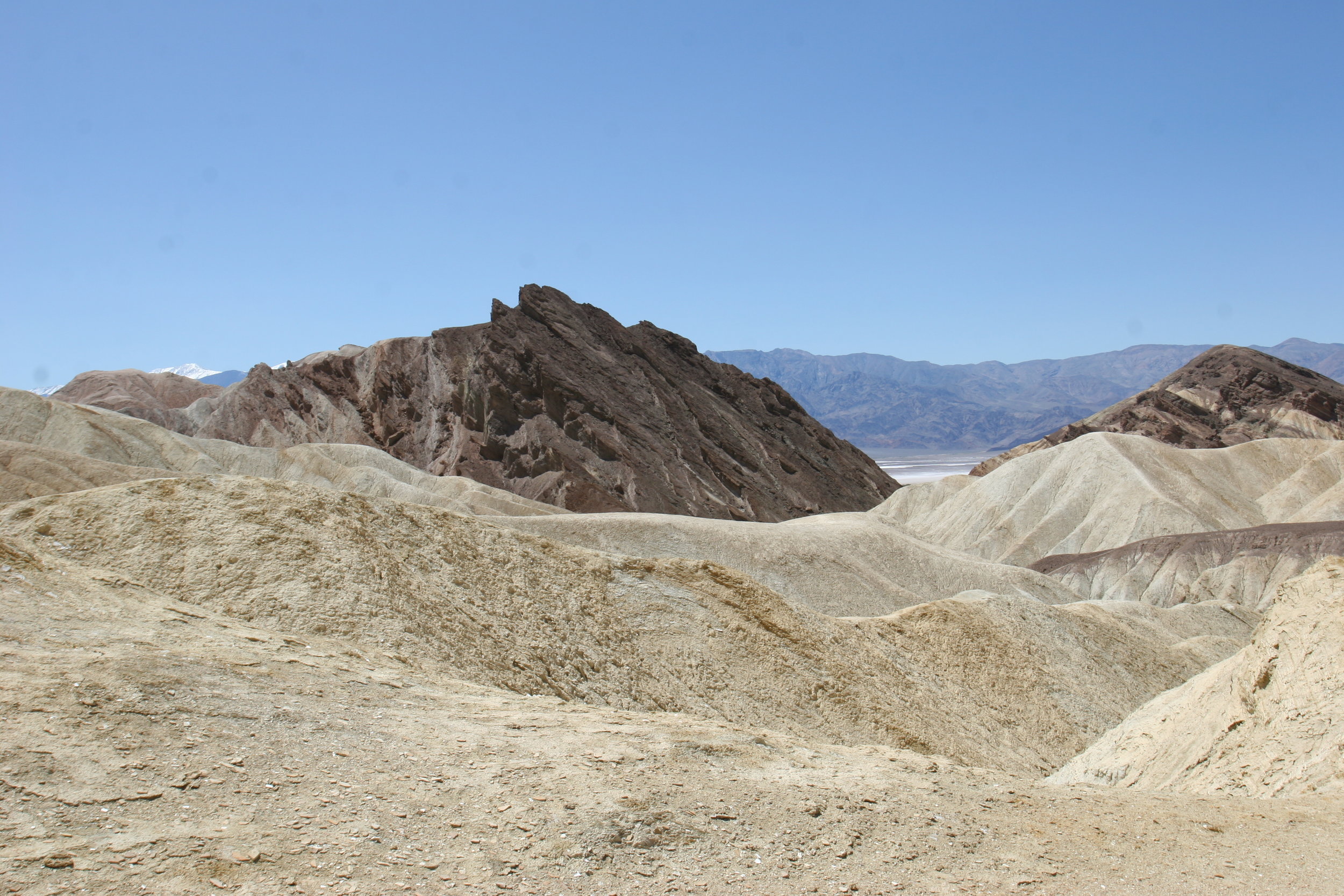
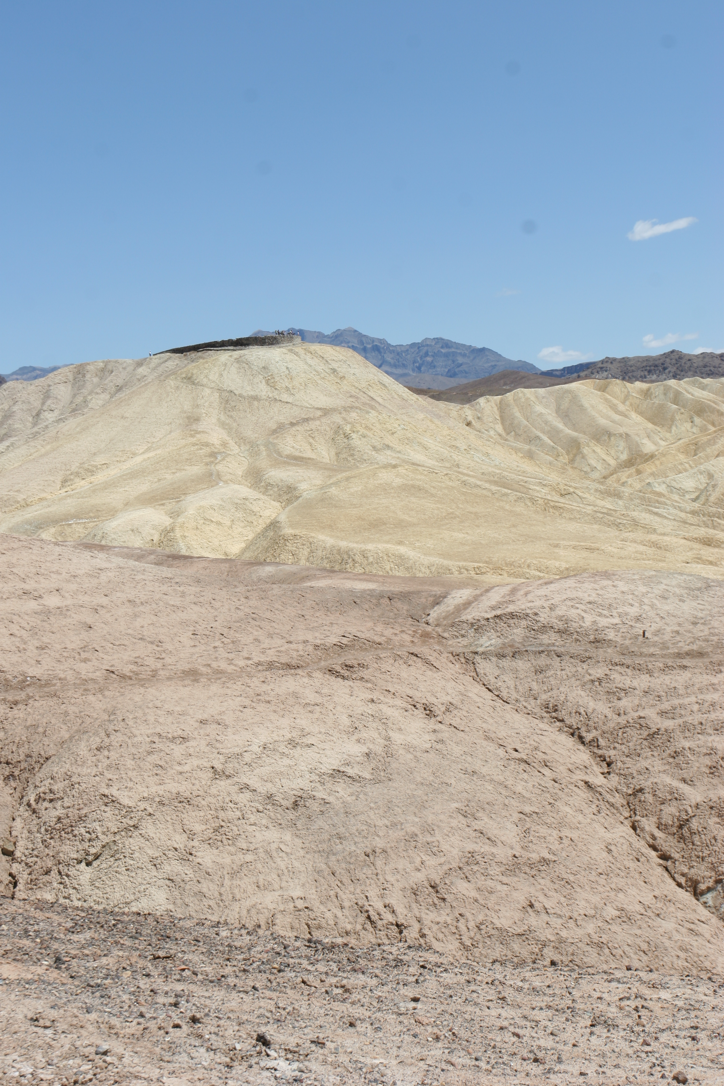
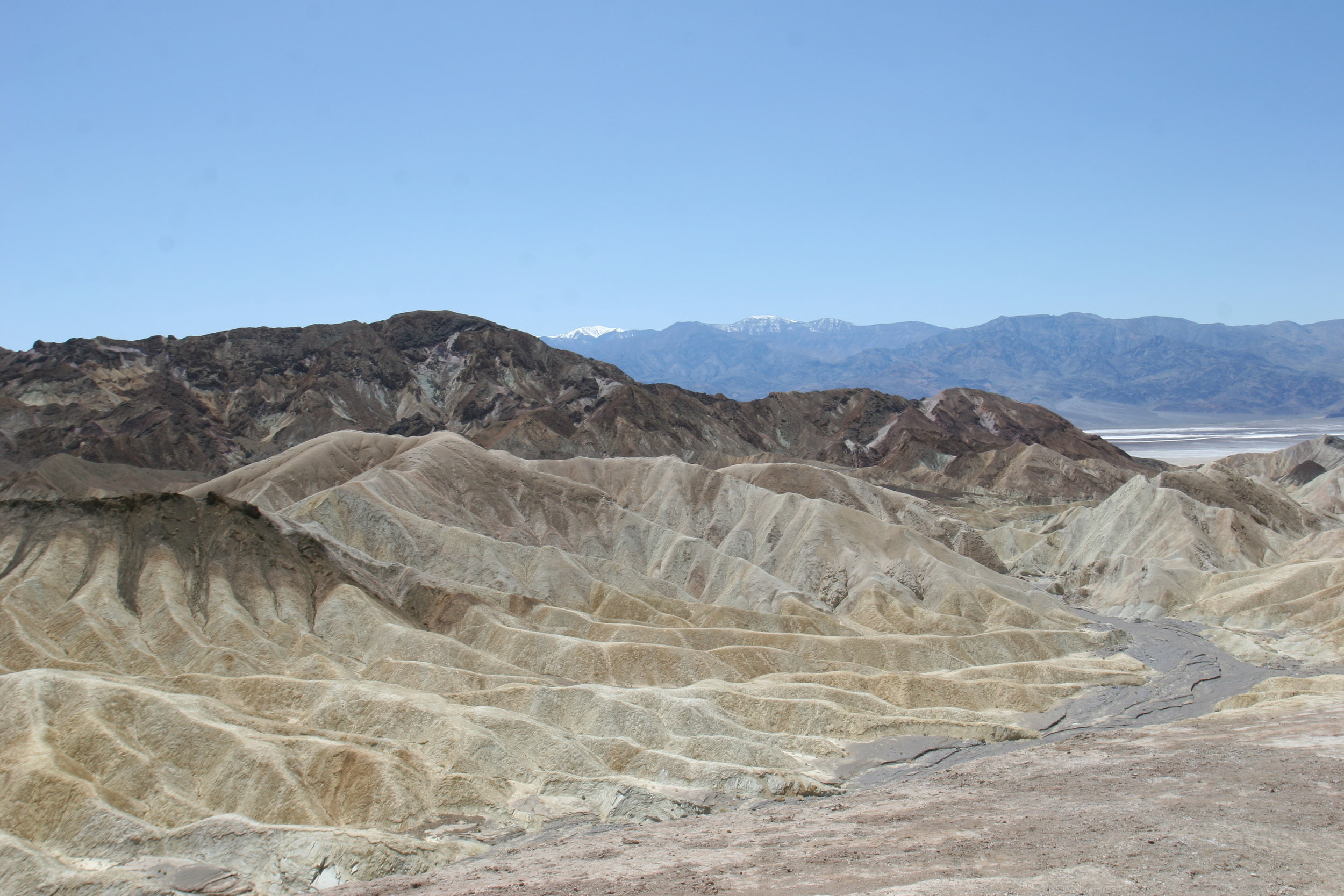
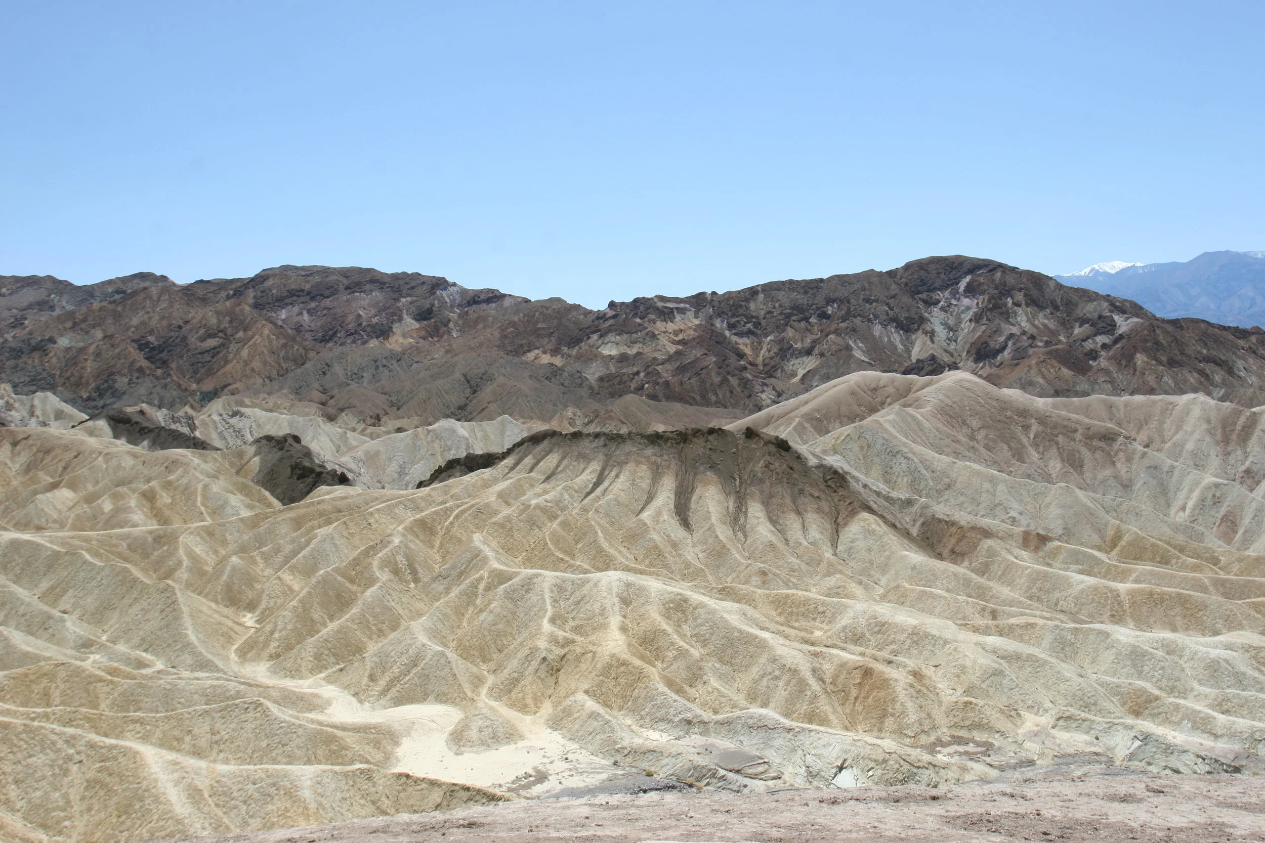
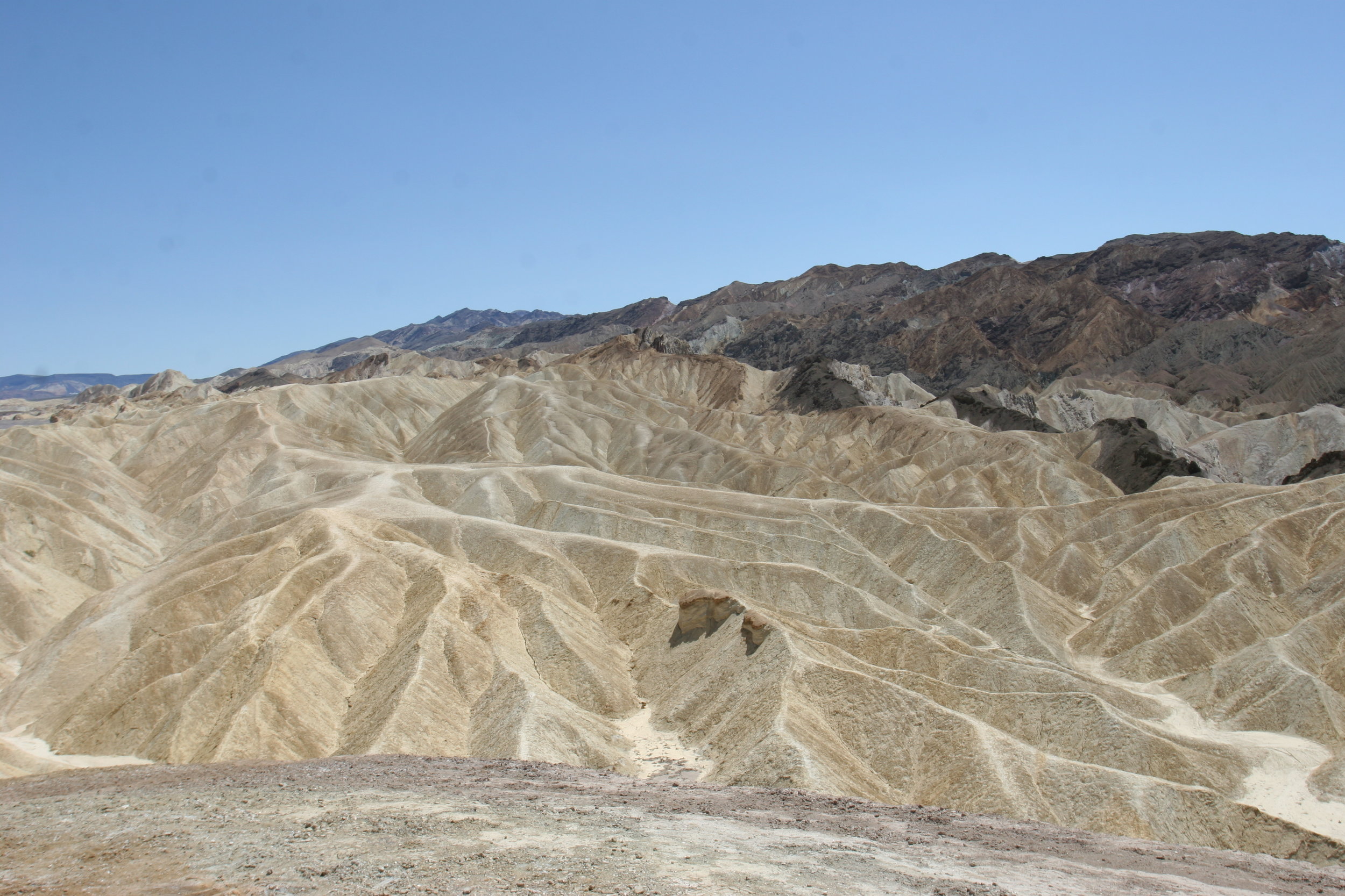
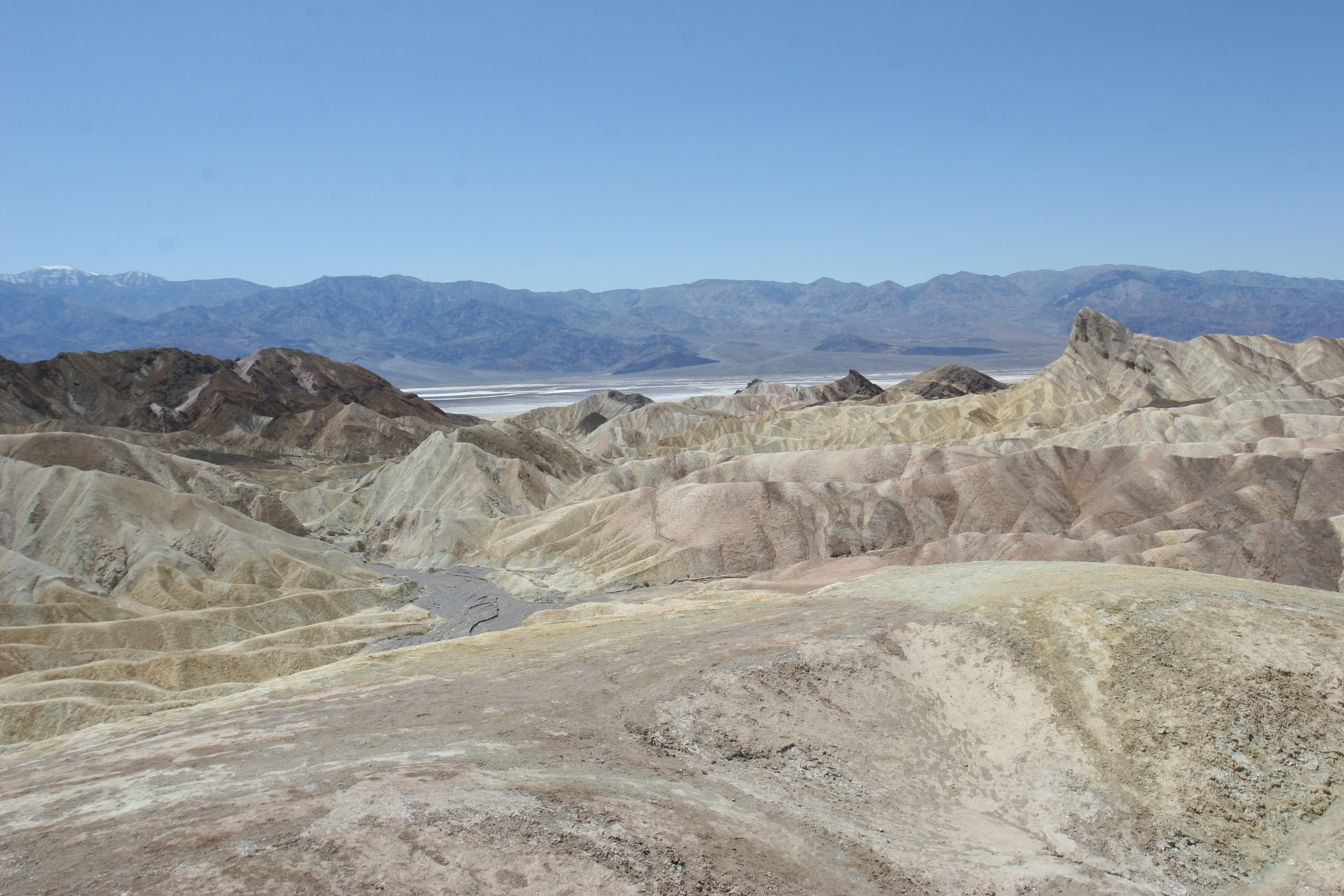
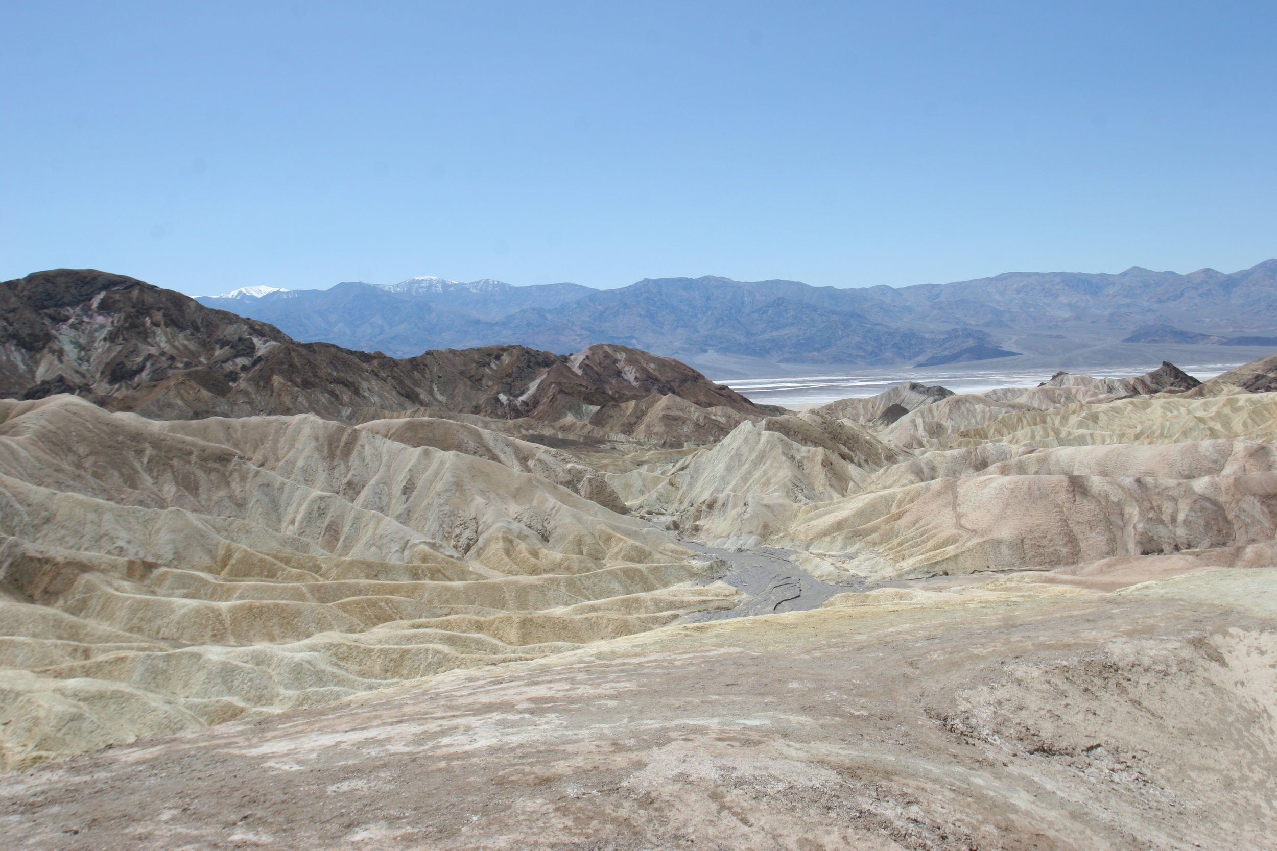
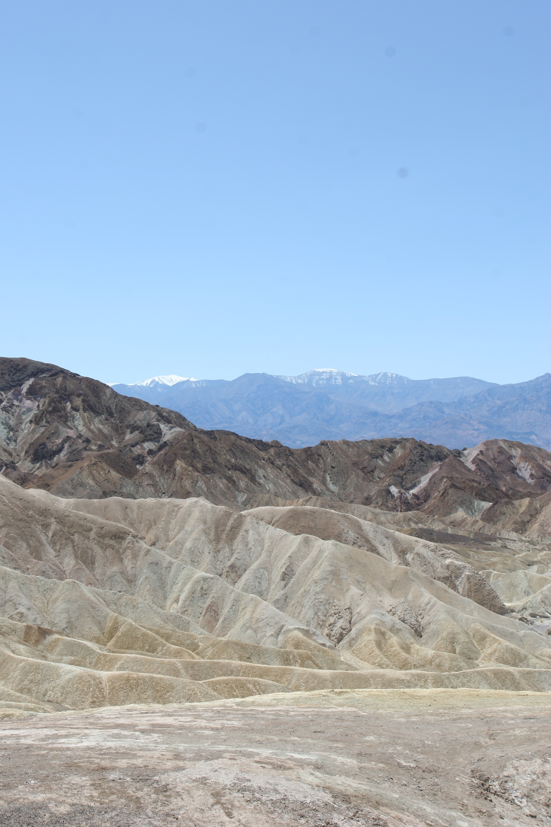
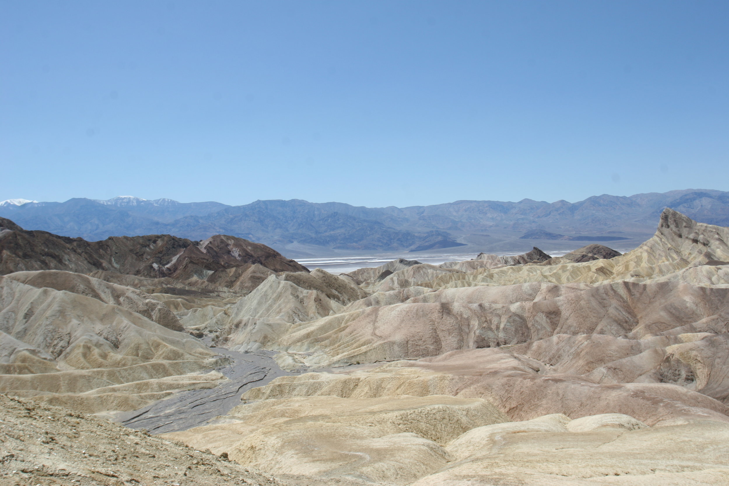
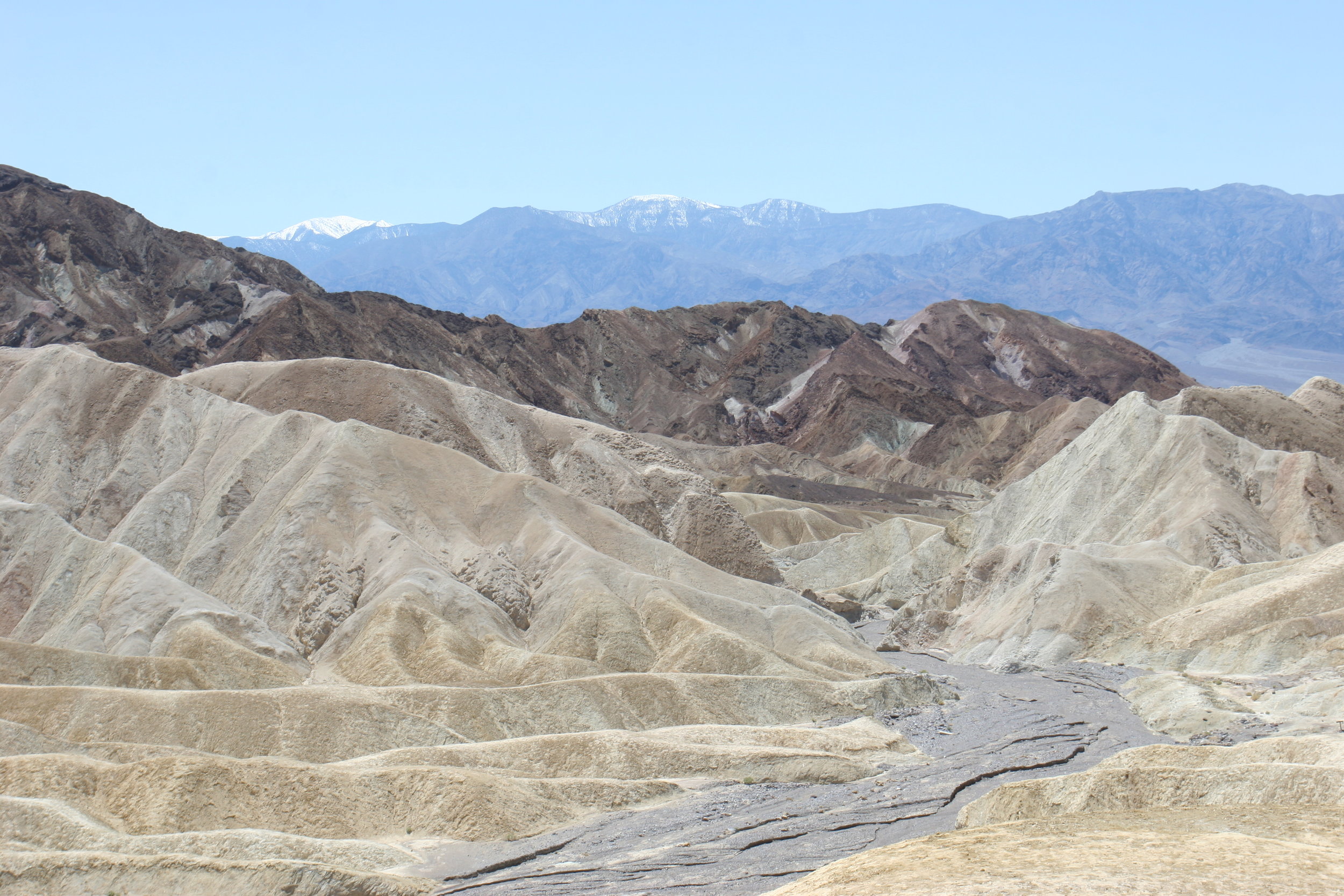
This last half mile of trail is steep, and does ascend a fair amount of vertical distance to Zabriskie Point; but the end result is worth the effort, as the view from Zabriskie Point encompasses the Manly Beacon, Gower Gulch, portions of Golden Canyon, the badlands surrounding them, and in the distance, Telescope Peak. From Zabriskie Point, you can either drive to other park destinations, should you have someone picking you up, or you can walk back down Golden Canyon for a total roundtrip distance of five miles (again assuming no additional stops). My personal preference is to head back to Golden Canyon through Gower Gulch (http://youtu.be/J_ndksa2t6s), which has interesting formations and slot canyons, for a total hike of six and a half miles (6.5), and this distance does include a stop at the Red Cathedral on the way to Zabriskie Point. Alternatively, you can start at Zabriskie Point and work your way down on these same routes.
Tips: Do take a map and plenty of water on this hike; as I noted above, there is the potential to get mildly, or if you are truly talented, excellently lost at places on this hike. Do also be aware that the majority of this hike is exposed, and you will get quite hot on it even in the wintertime. In addition to the tips described last week and today in the main body of the blog, a great spot for photos is once you are next to the Manly Beacon, facing West. You will have great views of Death Valley proper and the Panamint Range.