

White Mountain Trail to Barcroft Station
ne of the questions I seem to get a lot in Southern California about mountaineering is, “How is mountaineering in California different than say, Colorado”. At this point, I usually roll my eyes, because there are a plethora of differences that separate the types of climbing in both states. One of the main differences is that in Colorado, there are a lot of large peaks that you can get close to either by a paved road, or dirt access roads that are usually maintained by the Forest Service, or the residents of the inholdings around the road. California, has a lot of large peaks that require a lot of walking/hiking/backpacking to get to, such as Olancha Peak, or Mt. Whitney. I am aware from personal experience that Colorado has peaks that require a long approach; and California has drive-up peaks, so don’t e-mail me telling me that I’m wrong; I’m just generalizing. The exception to this generalization I’ve just mentioned is White Mountain, near the California/Nevada border.
Directions: The trail to White Mountain is located at the end of the aptly named White Mountain Road. I talked about directions to the Schulman Grove last week here, and these directions would get you to the trailhead of White Mountain, as all you have to do is follow White Mountain Road to the end. As I said last week, White Mountain Road from the Schulman Grove on is unpaved, and is sometimes in poor condition due to either snow or ice. While it is not a far distance from the Schulman Grove to the trailhead, chances are that the road conditions will prevent you from arriving there quickly. I would allow forty-five minutes to an hour of driving from the Schulman Grove to the Barcroft Station. Even though this section of the road is short, don’t feel like you’re in a rush – this is an interesting drive, and one with many beautiful things to look at as you head down the road.
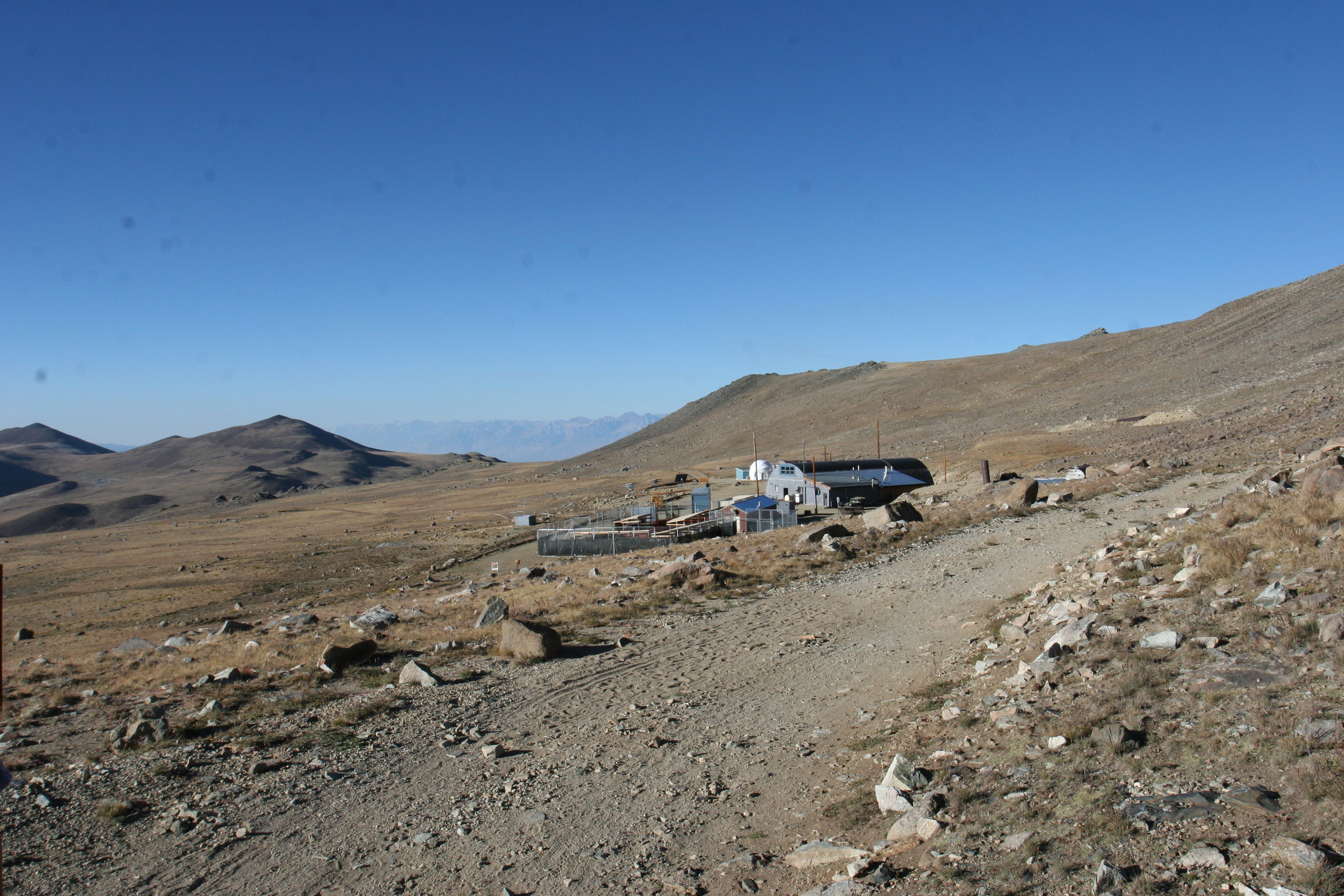
At the Barcroft Station Gate, the road ends, and from there, it is a semi-short hike to the top of White Mountain. Right before the gate, there is an area with a pit toilet, and numerous spots to park your car. While the entirety of this trail is pretty straightforward, the first two miles is particularly easy to follow as it is the road leading up to Barcroft Station. While it isn’t an area with a lot of traffic, the road does get some use in the summer, so keep your eyes and ears open for cars and trucks. While there is an uphill grade during this initial stretch, this is the easiest section of the hike. After two miles, the trail passes through the complex of buildings that is the White Mountain Research Station, also known as the Barcroft Station. While this facility is perhaps the highest high altitude laboratory in the world, it also ranks high on my scale of creepy-semi-industrial-government-or-resarch-structures-that-are-in-the-middle-of-nowhere. If the Devil’s Hole could be the setting for a B-Grade horror movie, Barcroft, or White Mountain Research Station could be the setting for an A-Grade horror movie, such as the Thing, or anything else, especially with the herd of sheep that are present on site. Having said all of that, I’ll let you draw all of your own conclusions about the site, especially as I’ve seen nothing strange there except for the infamous goat sign.
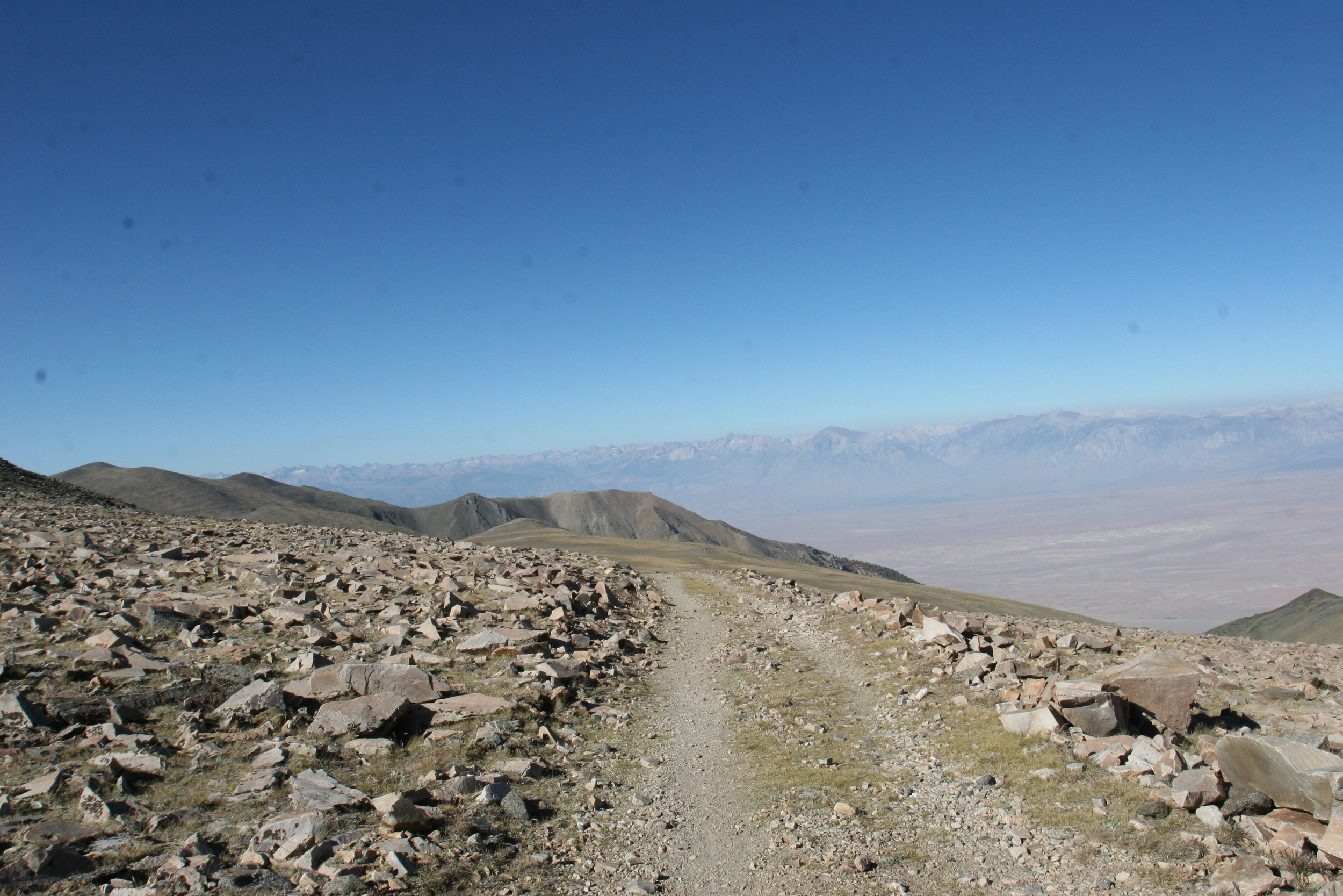
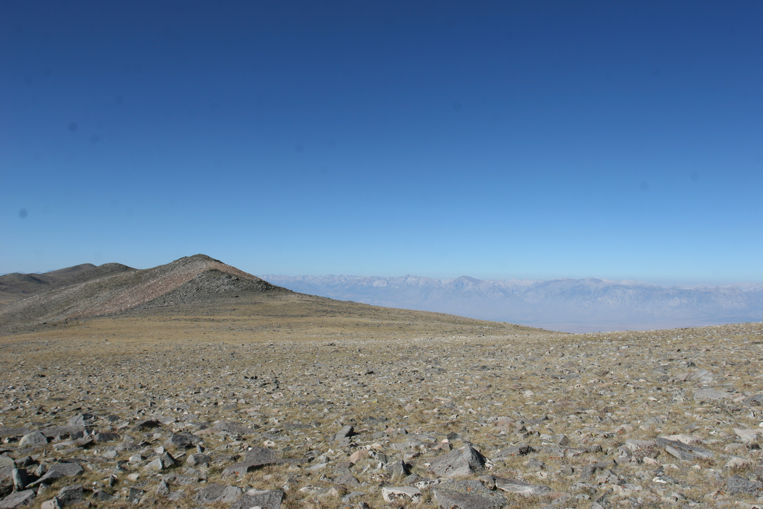
From Barcroft, the road ends, and you will find yourself on the actual trail that leads up to White Mountain. Immediately after the sheep pen, the trail starts to gain some actual elevation. After about half a mile, you will find yourself at the top of a long plateau at approximately ~12,900 feet. At this point, you may think to yourself, “wait a minute, the trail starts at 11,680 feet (which it does), and the summit is at 14,152 feet, once I reach the plateau, I have this in the bag”. To this I have to say, yes – and no. If you go in the middle of summer, when there is no snow, White Mountain is one of the easier fourteen thousand foot peaks to summit, as it is a walk up that allows you to start from a high elevation.
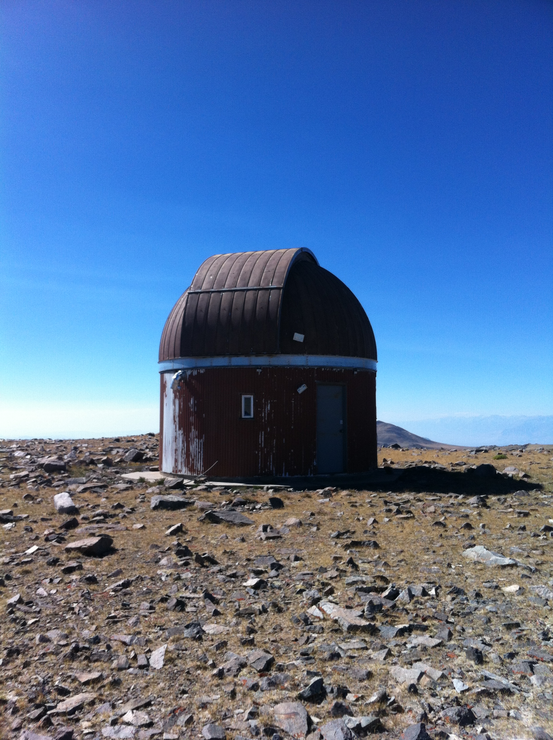
But – and there’s always a “but” when you’re talking mountaineering. Even though it is “easy” under those conditions, you still have to hike fourteen miles roundtrip. You still have ascend over 2,500 feet, and you have to descend those same 2,500 feet. You will also have to acclimatize, and you will also have to be prepared with plenty of water, food, and you will have to be ready to deal with a lot of sun exposure during the climb. Finally, you’ll also have to deal with the exposed and windy sections of the mountain that are past the Observatory Dome. Both times I have been on the mountain, I have been pummeled by the winds coming across the plateau heading up to the peak.
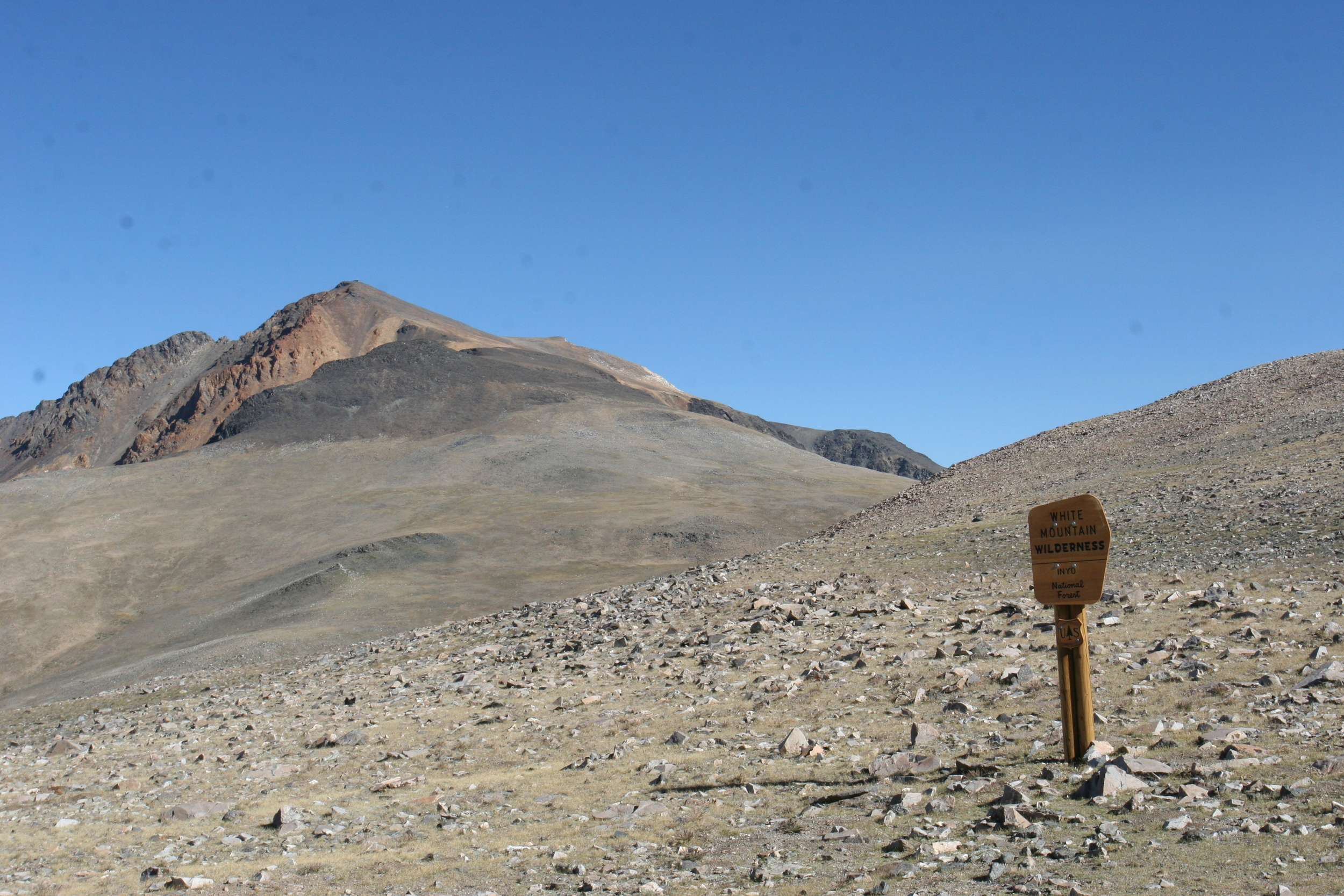
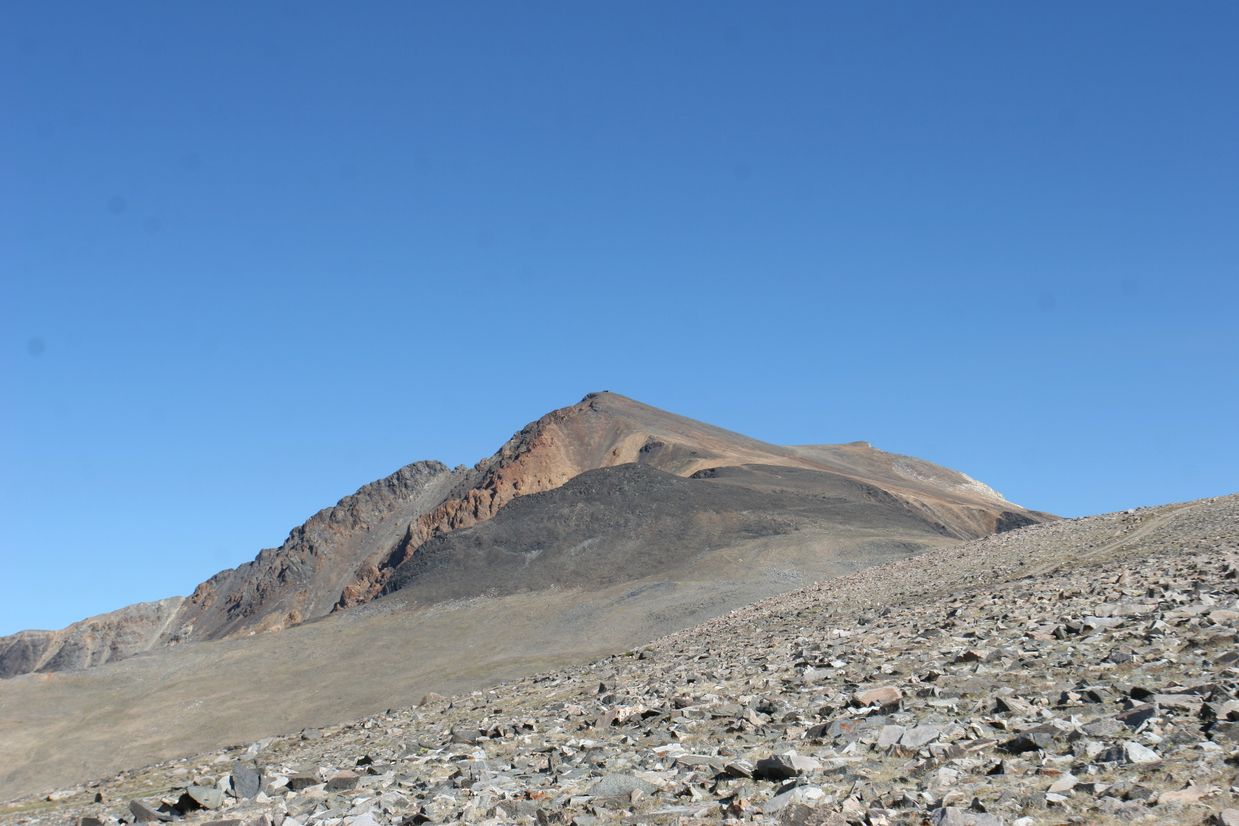
These high winds that scour across the plateau are brutal for a number of reasons – they dehydrate you; they lower your core temperature; and at times, it seems like they are tearing the air from your lungs. Once you cross the plateau, which is at first a gradual downhill slope, followed by a gradual uphill slope, you will begin ascending up and over a number of small saddles. At this point, you will pass a randomly placed sign that is well off trail that notes you are in the White Mountain Forest. Just after this sign, the trail begins to ascend steeply up the talus covered side of the peak. This section of trail is not for the faint hearted – it is steep, and there are spots where a slip or fall could cause serious injury – and it is full of loose rocks. If you keep your head down during this section and keep climbing, you will find yourself on the summit, next to the hut, and with some great views of the Sierras, Nevada, and everything around for hundreds of miles. Once you have had enough of the view, follow the trail back to the parking lot at the gate.
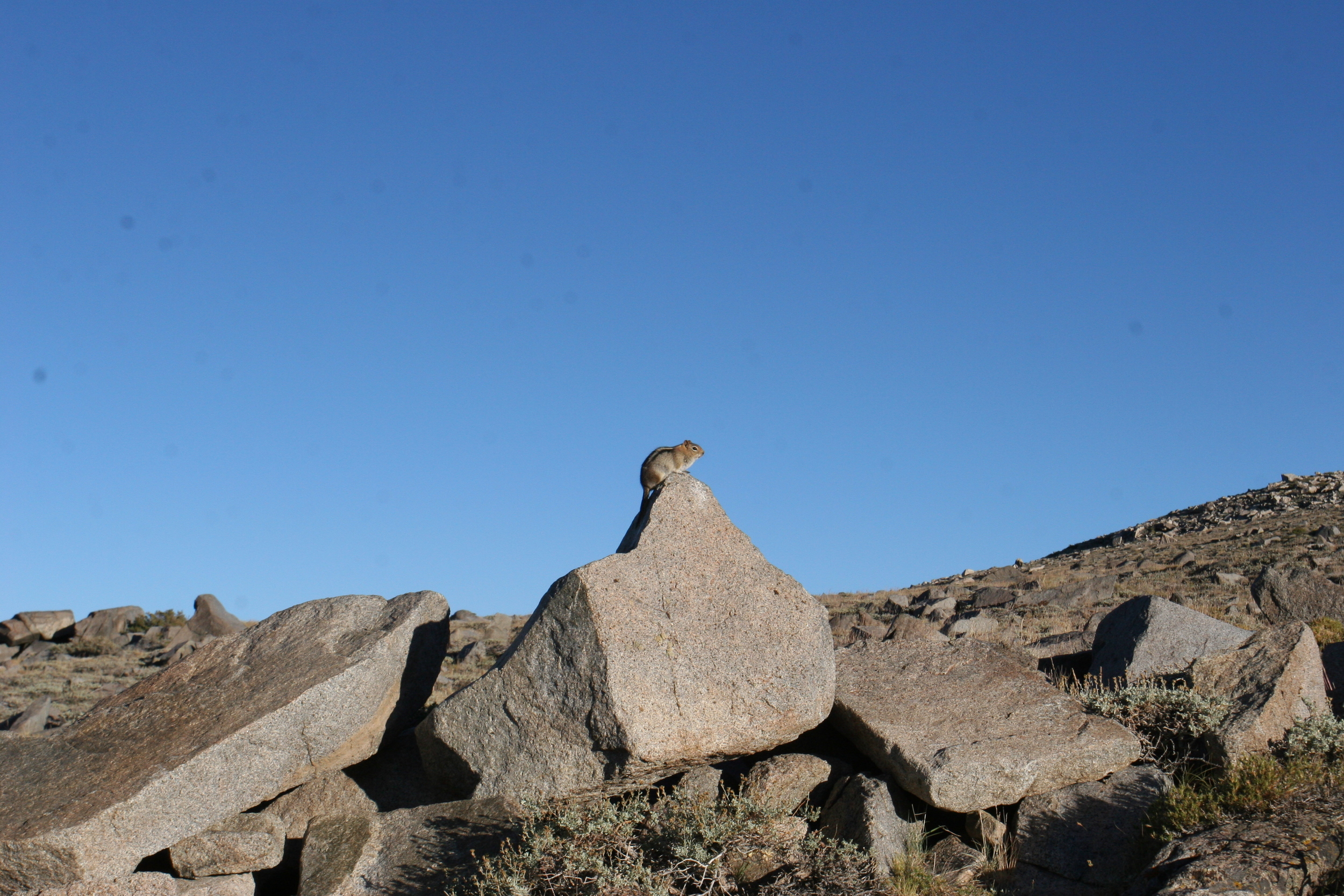
Key Facts: White Mountain is 14,152 feet tall, and if you are going to take this route, the standard Southern approach from the Barcroft Gate, it will be fourteen miles roundtrip, starting from 11,680 feet. Watch for marmots!