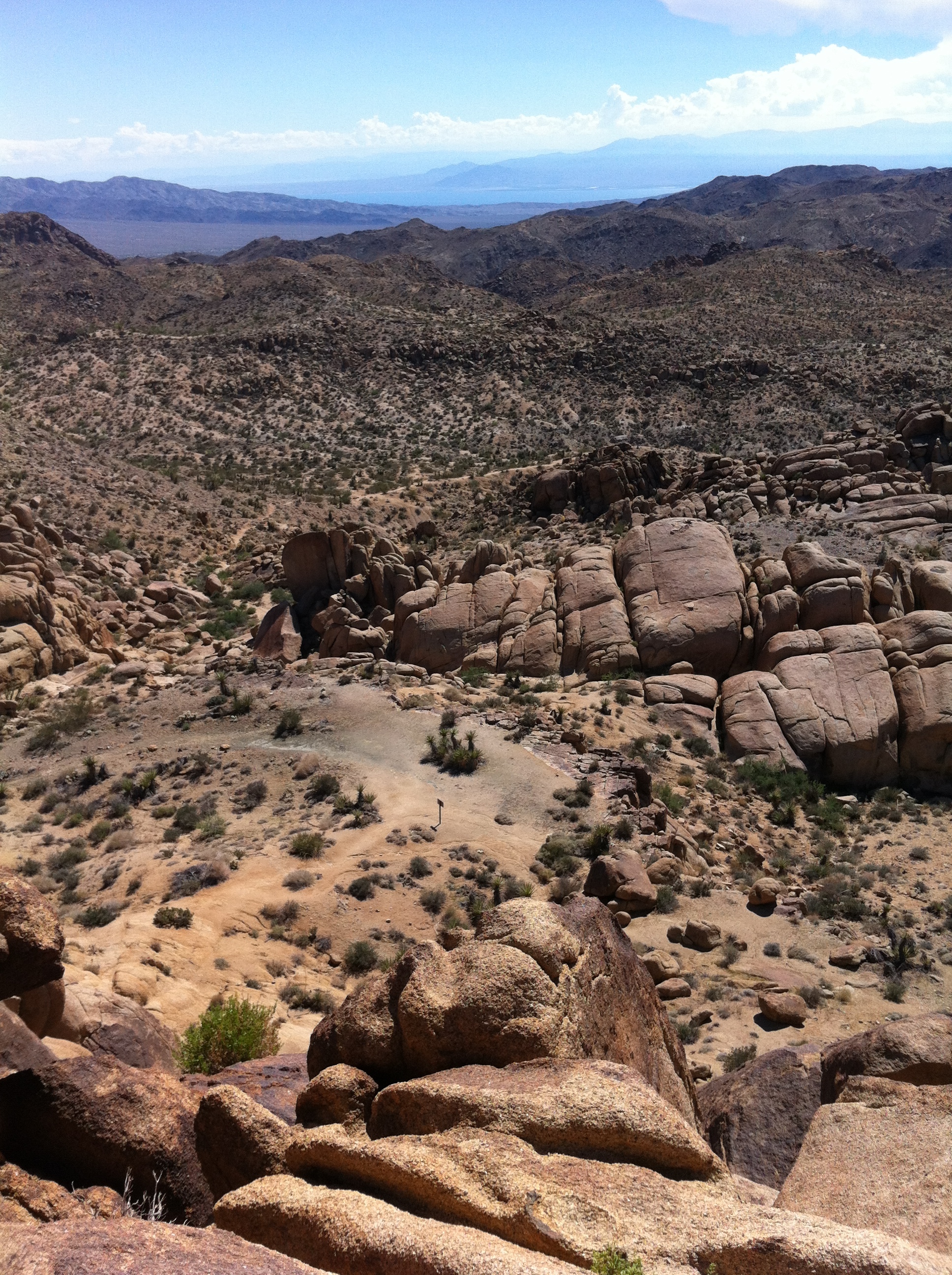
View from atop Mastodon Peak, Joshua Tree National Park
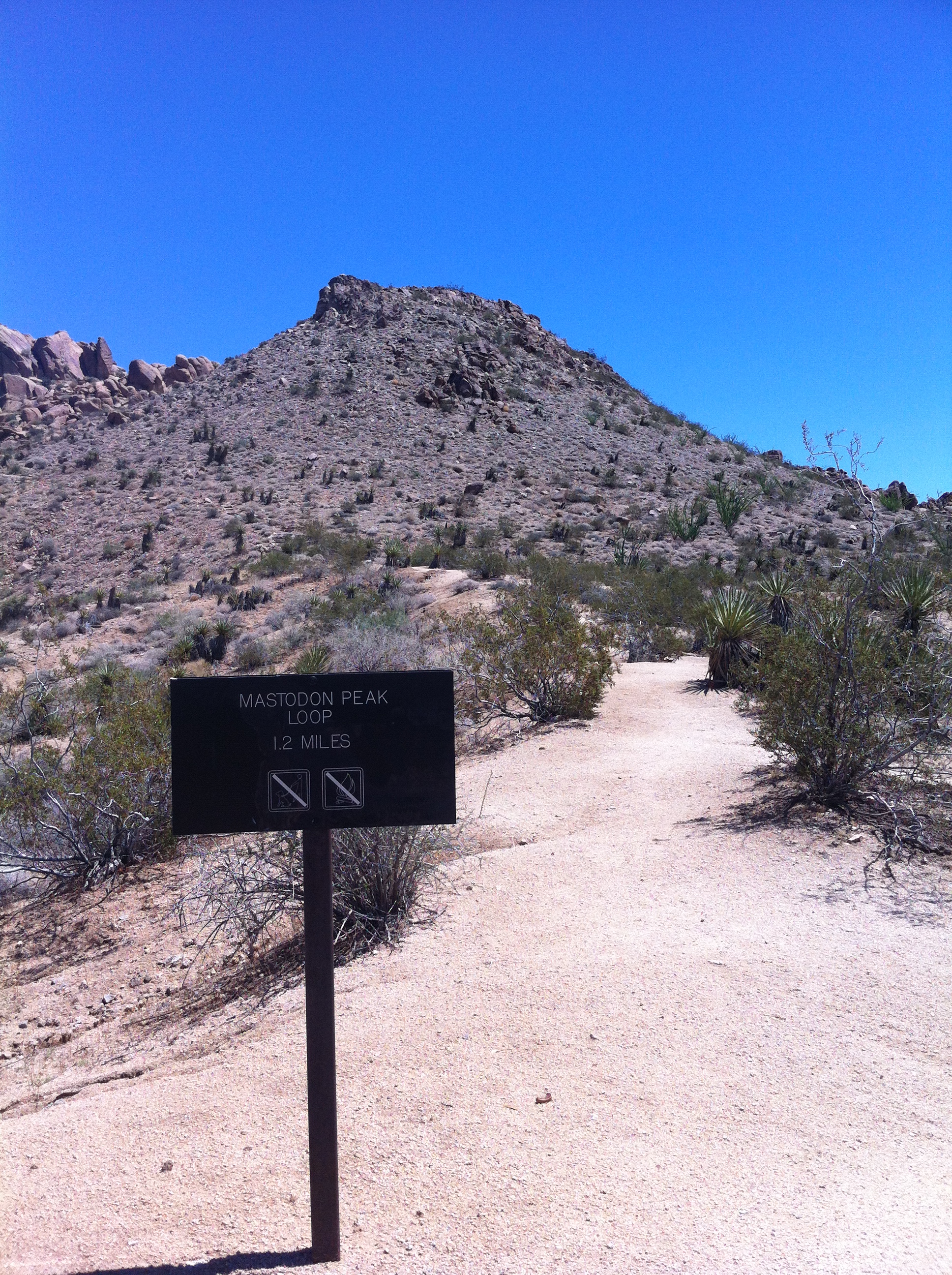
Joshua Tree National Park is known for one thing, and one thing only: rock climbing. This is a good thing: there are many great routes in the park for climbing. As I have climbed there many times, and have recommended it to many people, there is no way I could complain about that association. However, there’s a lot more than just climbing going on at Joshua Tree. There’s excellent stargazing; excellent spring blooms; and excellent hikes, both day, and multi-day. One of the shortest and the most popular hikes in the park is the hike from Cottonwood Springs to Mastodon Peak. There are two ways to do this hike: first, as a loop trail from the Campground (“the Mastodon Peak Loop”) or as part of the longer hike to Lost Palms Oasis. The loop trail is 2.6 miles long roundtrip; and if you add the Mastodon Peak section of trail to the Lost Palms Oasis hike, you are left with a hike that is 8.2 miles roundtrip.
Mastodon Peak, Joshua Tree National Park
If you’ve ever read my blog, you know that I’m a glutton for punishment, so when I went out to Mastodon Peak, I elected to climb it as part of the Lost Palms Oasis hike, which I’ll talk about next week. If you’re interested in the loop trail, there’s a number of great trail reports out there about where to go and what to expect, especially from my friend WalkSimply, and others. (Here, here, here). If you’re not looking for an 8.2 mile roundtrip desert adventure, I’d recommend that you take the loop trail, as it looks like a lot of fun, and is probably better suited for a majority of weekend adventurers.
Directions: Follow the I-10 East from Indio, California, and exit on Cottonwood Springs Road and head North. There are numerous signs on the I-10 that also direct you to take the Cottonwood Springs Exit to enter Joshua Tree National Park. From the freeway, head north for a little over seven (7) miles to the Cottonwood Visitor Center. From the Visitor Center, take a right hand turn, and drive one (1) mile to the trailhead parking area. From the Visitor Center on, the area is well signed and you cannot get lost. The trailhead leaves directly from the parking area.
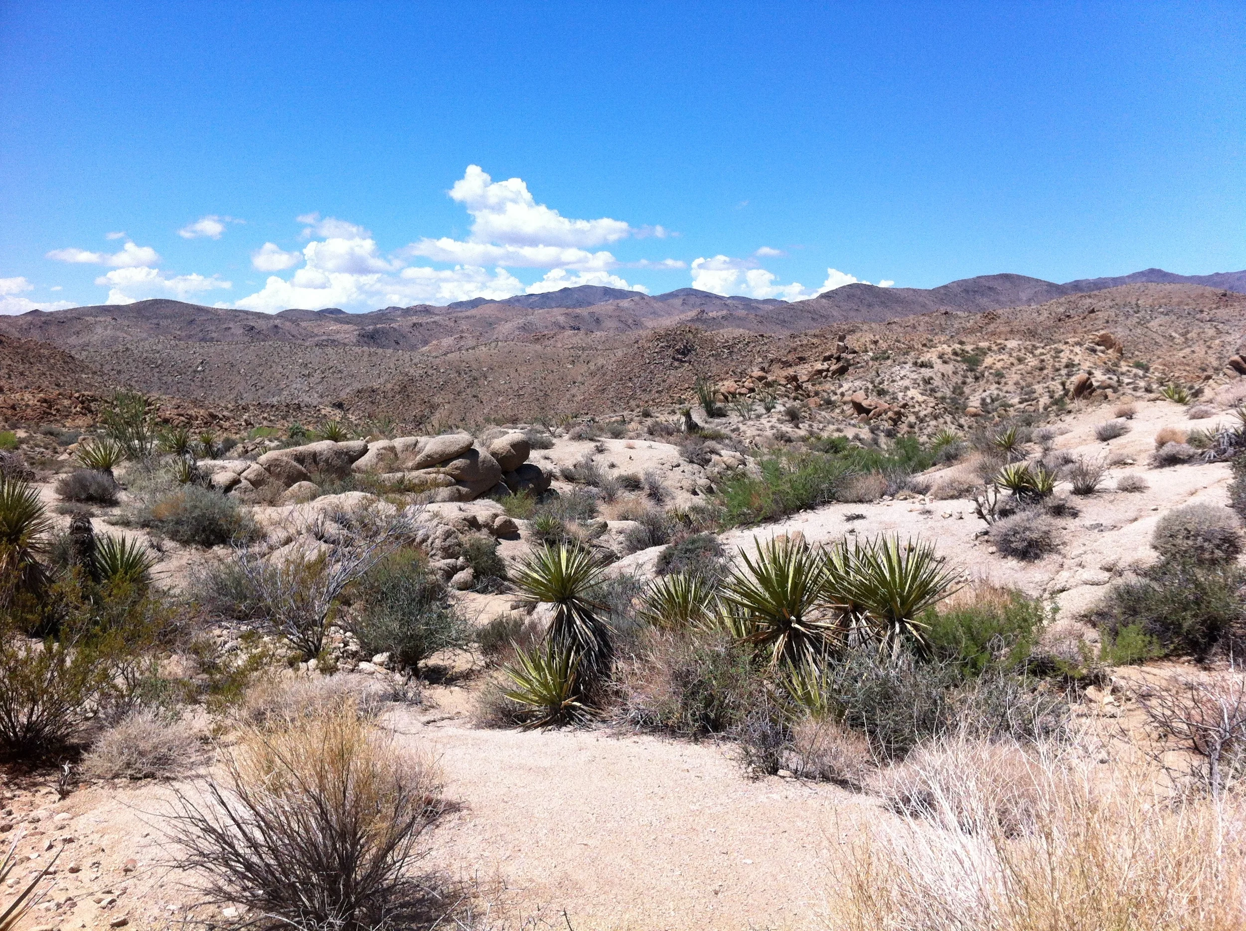
At this point, my first two tips are these: whether you are taking the loop trail or the Lost Palms hike, you should be aware that this trailhead is one of the more popular trails in the park, and during the winter, parking may be at a premium. Then again, if you are here during the summer as I was, you may find the parking lot deserted. Second, irrespective of which season you visit Joshua Tree, you should plan on bringing plenty of water as it is the desert. From the trailhead, the trail heads down into a small wash with some palm trees, before heading up slightly to a ridgeline. The trail is well marked and signed; and at .7 miles, you will be at the trail junction for the Mastodon Peak Loop/Lost Palms Oasis trail. I elected to head out to Lost Palms Oasis first; and then climb the peak on my return – other people may wish to climb the peak first and get what elevation gain there is out of the way first. If you are taking the loop trail, this is where you will turn, and it is well also well marked.
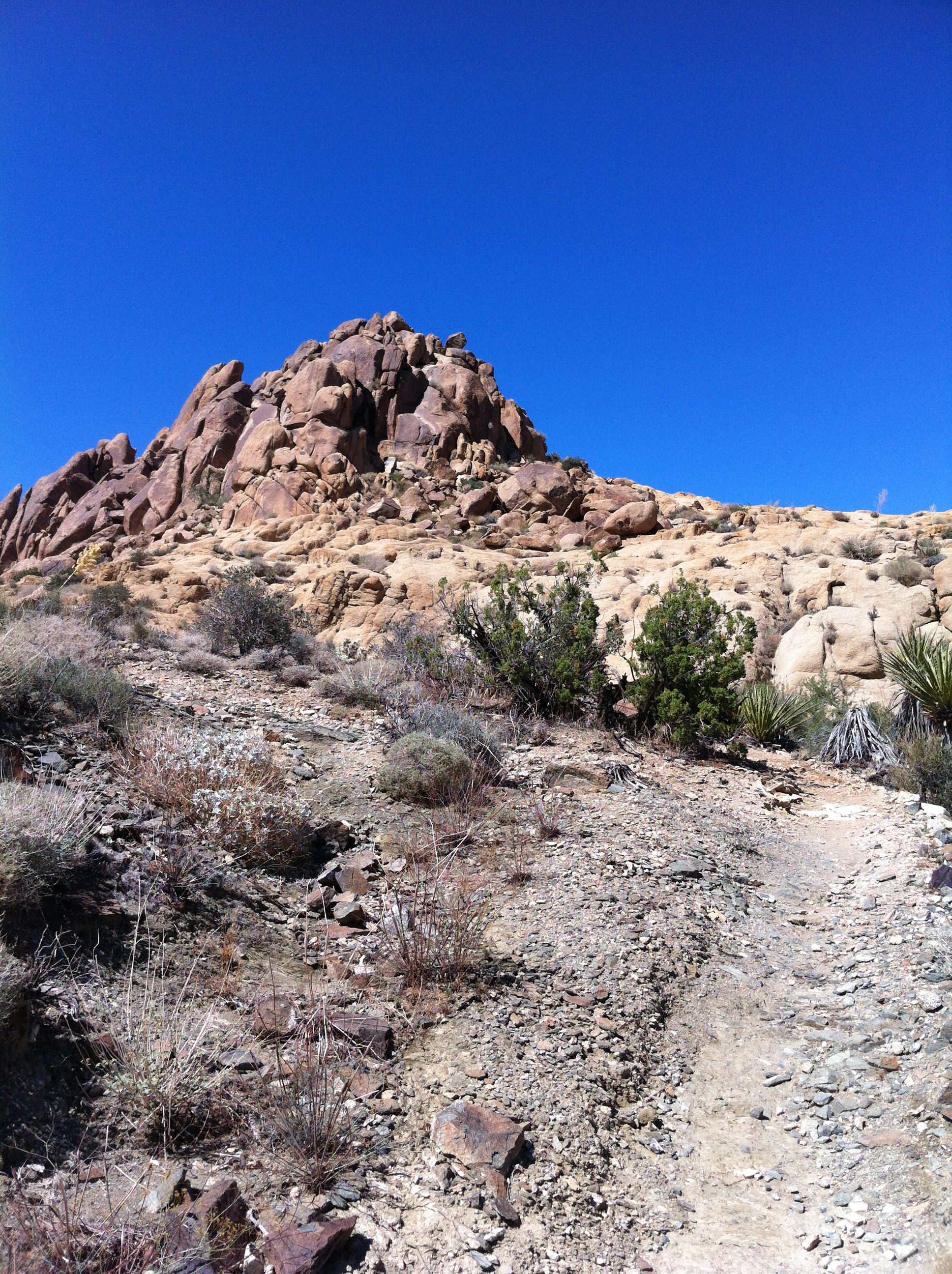
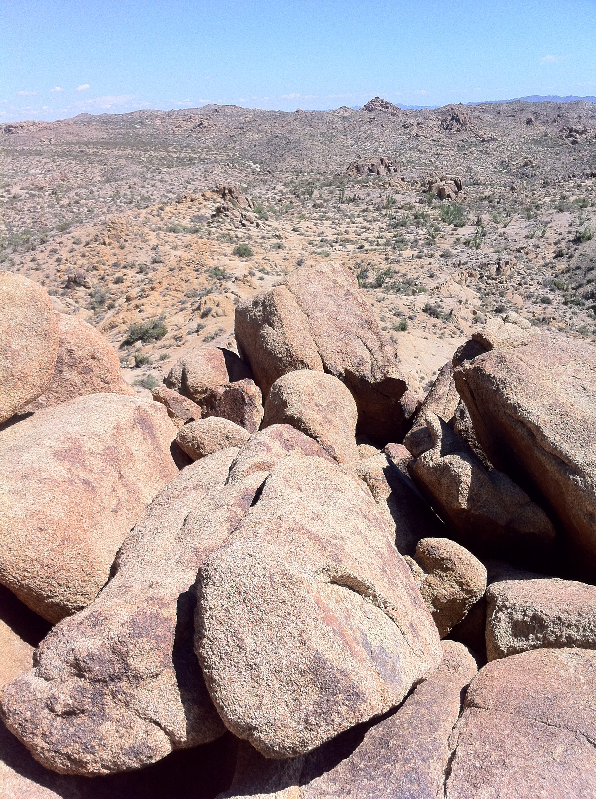
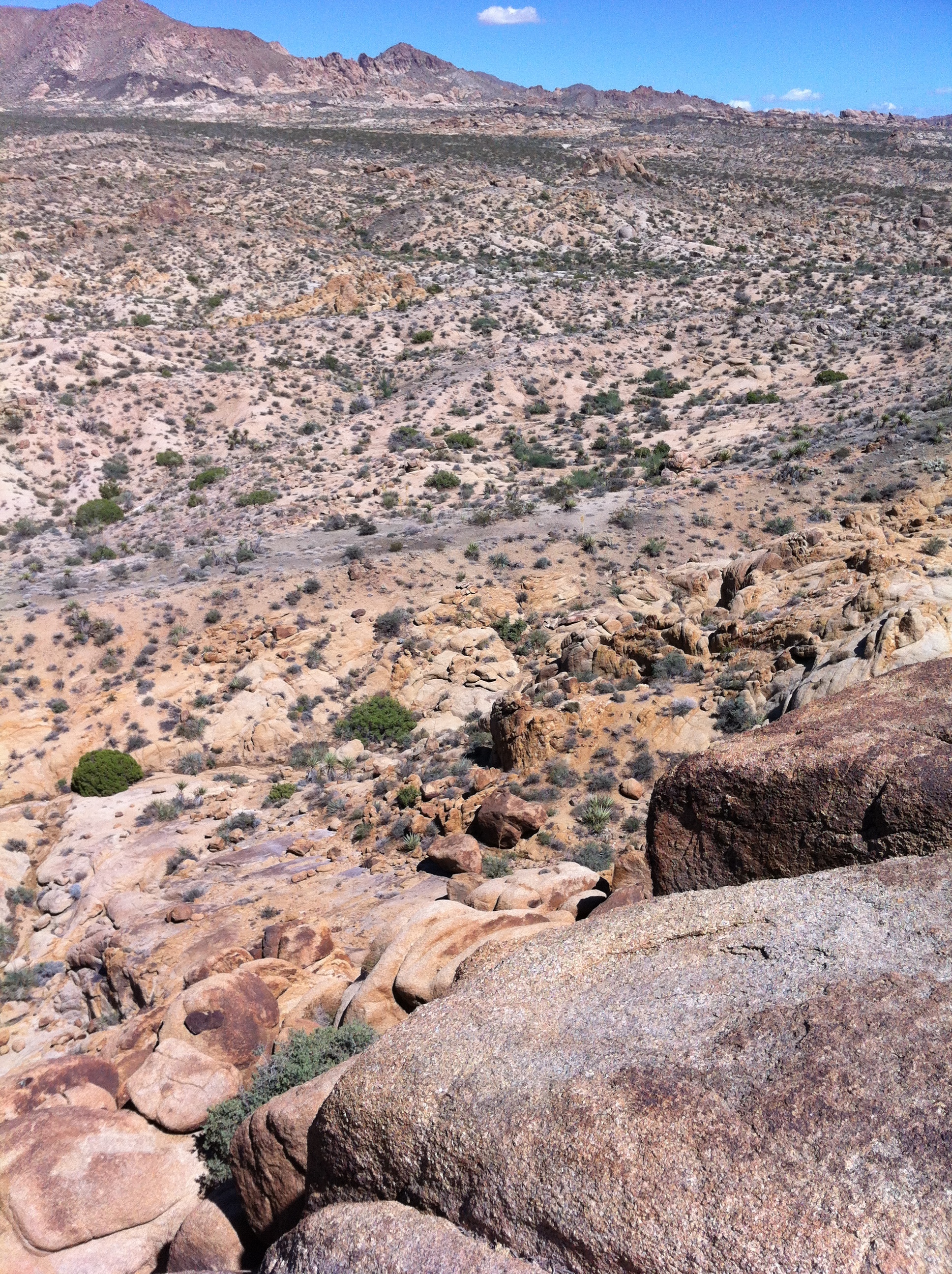
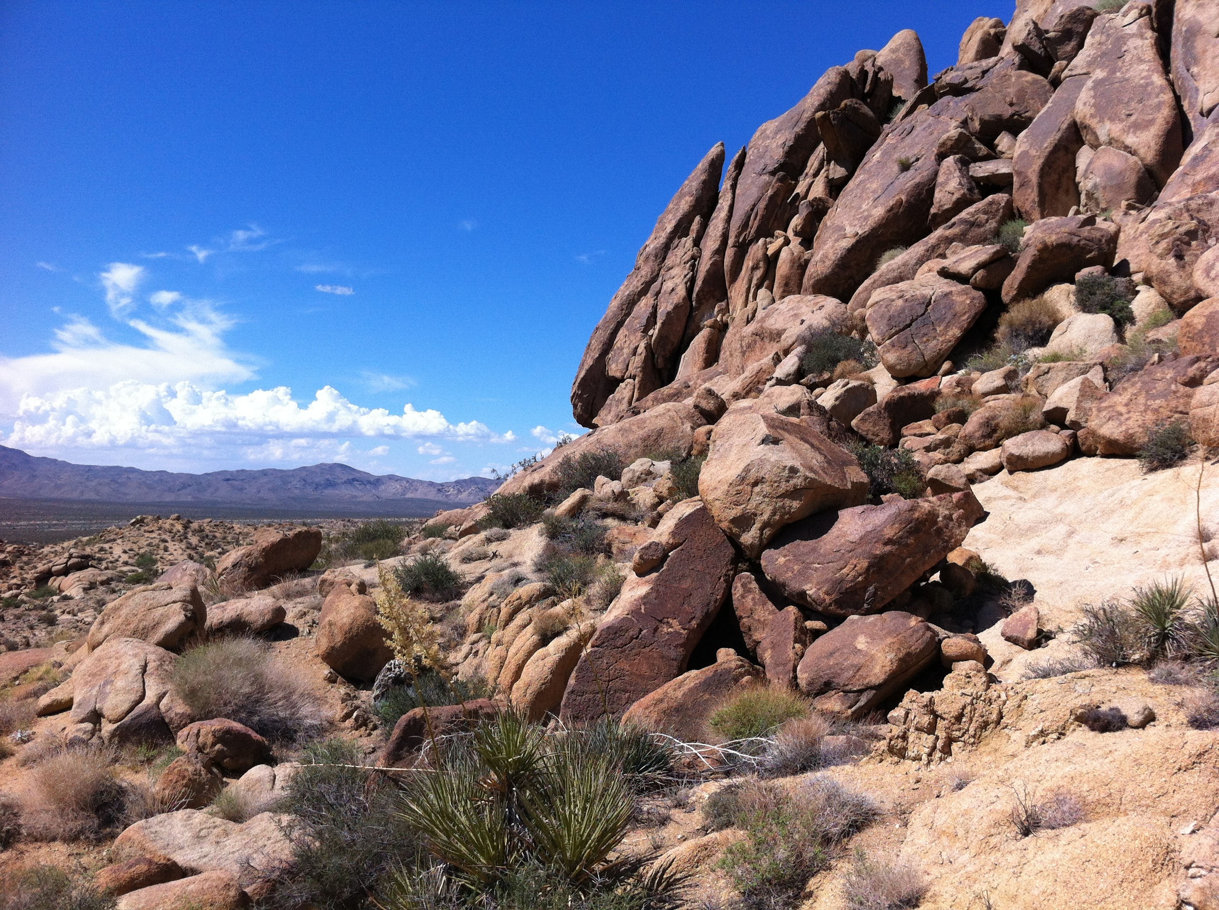
From the trail junction, the trail ascends the majority of the 400 feet of elevation gain over a .2 mile distance. Even though this is not a lot of elevation gain, going from 2,971 feet to 3,371 feet, if you are coming from sea level, or it is a hot day, you probably will be feeling it a little bit through this section. Personally, I enjoyed this section of the trail to the peak the most as it traverses through an interesting rock canyon with rock steps at places; and because there were numerous chuckwallas running through the area when I hiked up. Once you have hiked through this area, you will be at the base of the “peak” itself, which is a large pile of boulders/rocks.
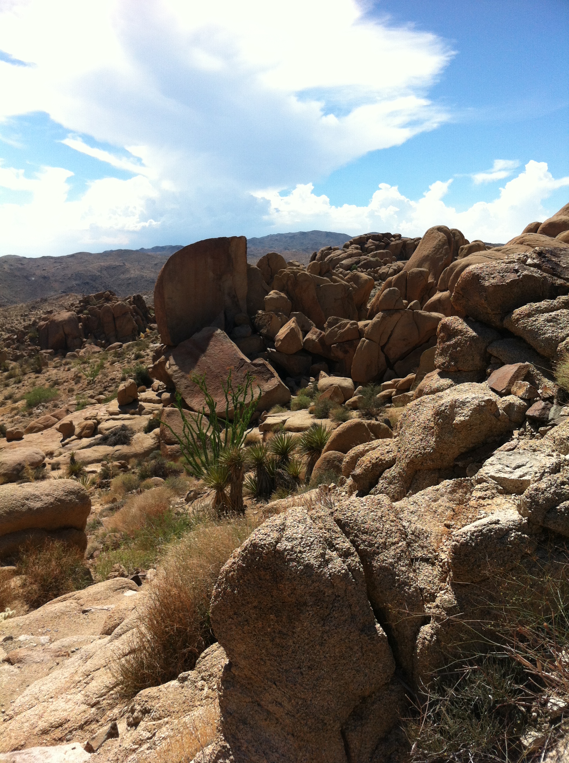
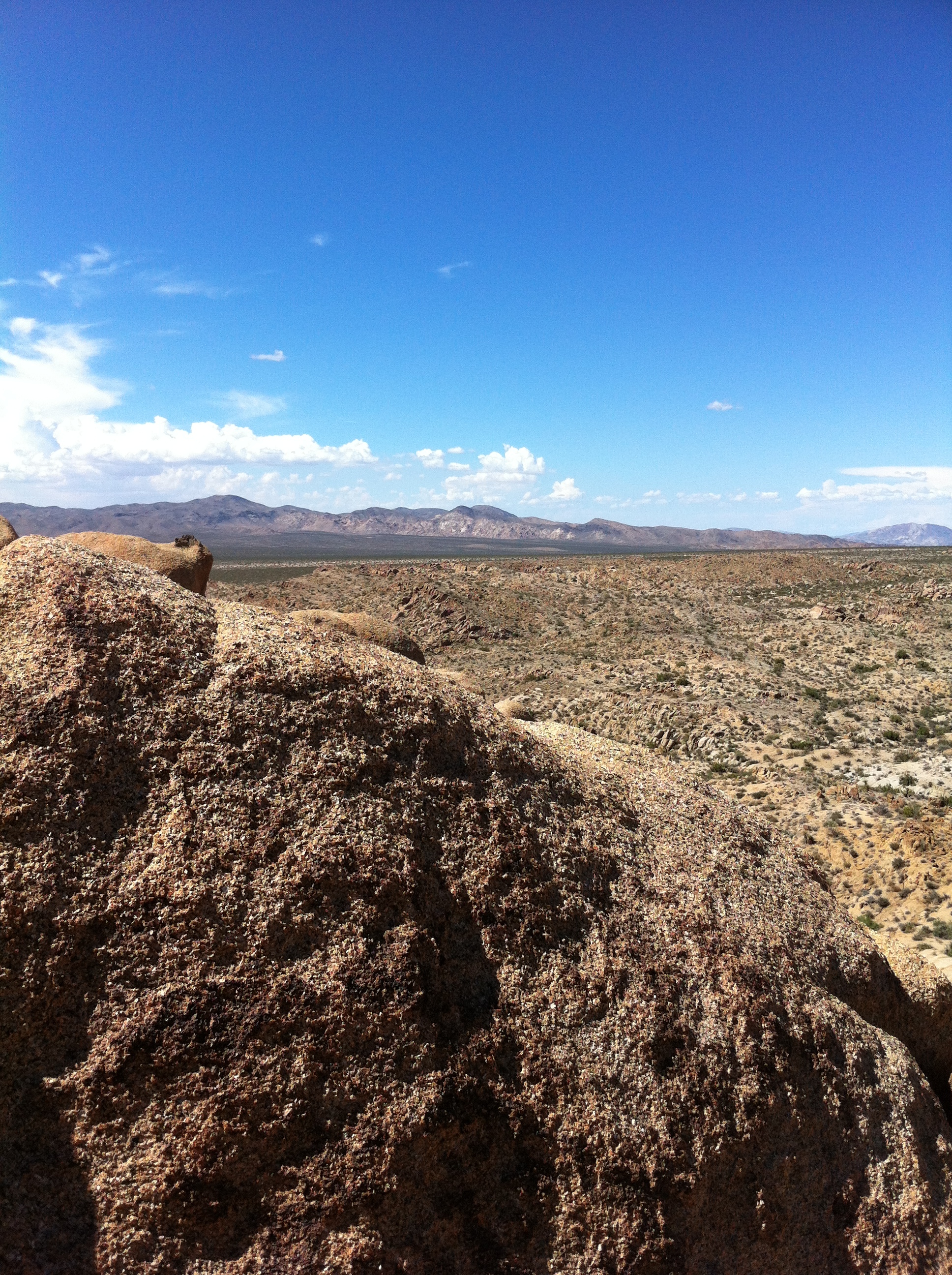
At this point, it is a scramble to the top no matter which way you go, so the summit ascent is nothing but personal preference. If you have rock climbing experience, and it is not a hot day, you could climb/boulder up some of the cracks on the South/West faces of the peak. If you’re looking for the easiest, and the shortest route to the top, however, I’d recommend circling to the right (east) as you face the peak from the trail (looking North). From this point, you will cross a number of rocks and walk up to the peak. From the summit, you have one of the best views in the park – a 360 panorama of the surrounding terrain, and on a clear day, the Salton Sea to the South. If you have not been to Lost Palms Oasis yet, follow the trail back down to the junction and continue on; and if you have been to the Oasis, continue back to the junction to the trailhead, or on the loop to the campground.
Tips: This trail can be as easy, or as challenging as you want. If you go in the winter, the temperatures will be moderate, and this is a decent hike at over 8 miles of roundtrip distance. I went on this hike in late August, and by the time I reached Mastodon Peak, after hiking 7 miles in a 115 degree muggy heat, I was gassed, and the hike was a challenge to say the least! It’s also worth noting that there’s a mine by the trail, if you take the loop trail, and if you’re in Joshua Tree, you should check out the Integratron to see something truly unique