

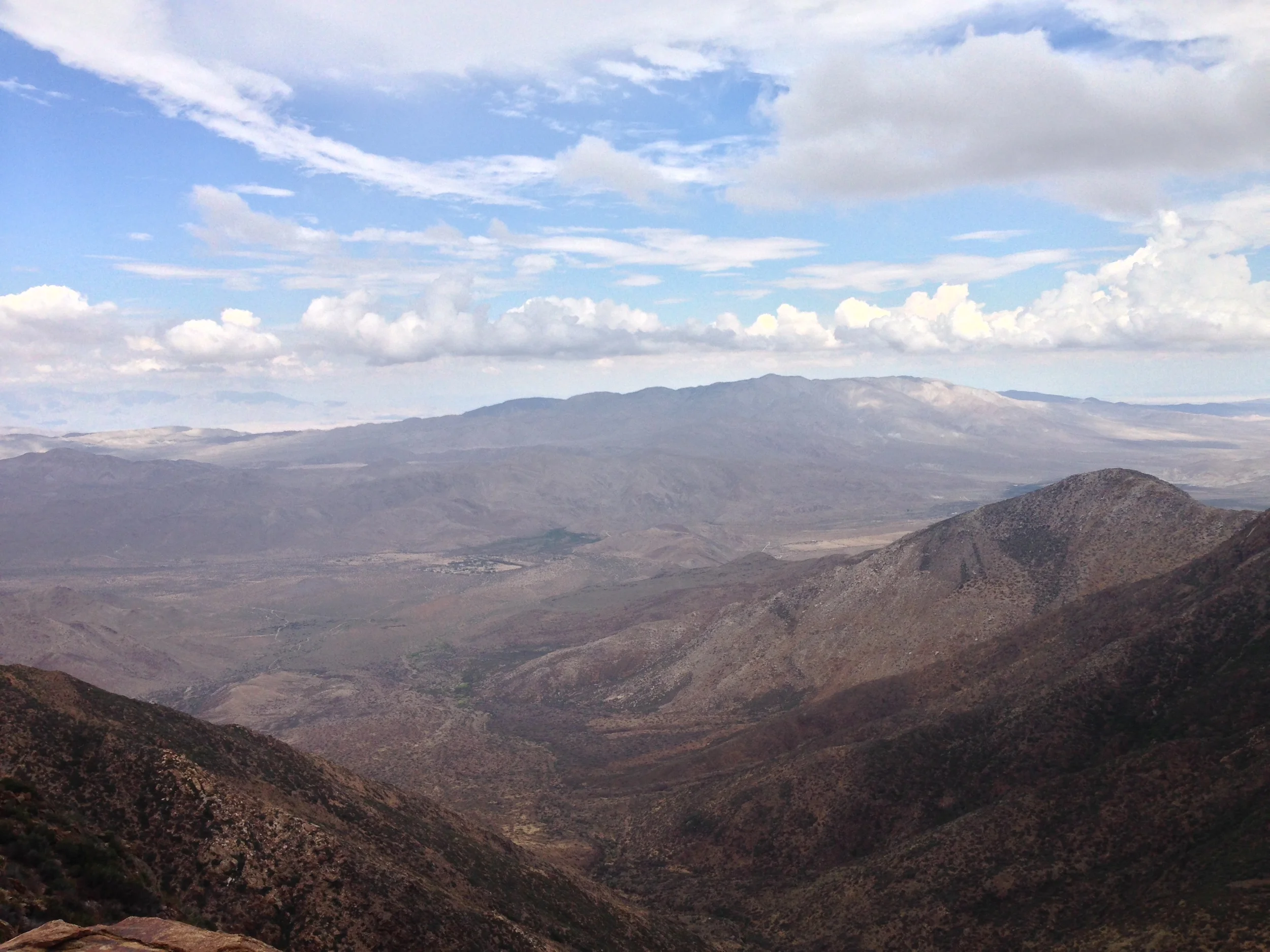
One of the more obscure and strange hiking destinations in San Diego is located on the Eastern border of the county, and sits right on the border of the Anza-Borrego State Park and the Cleveland National Forest. In addition to being one of the strangest hiking destinations, the spot has some of the best views in the county as it is located on the edge of the Laguna Mountains.
Oak Canyon, Mission Trails Regional Park
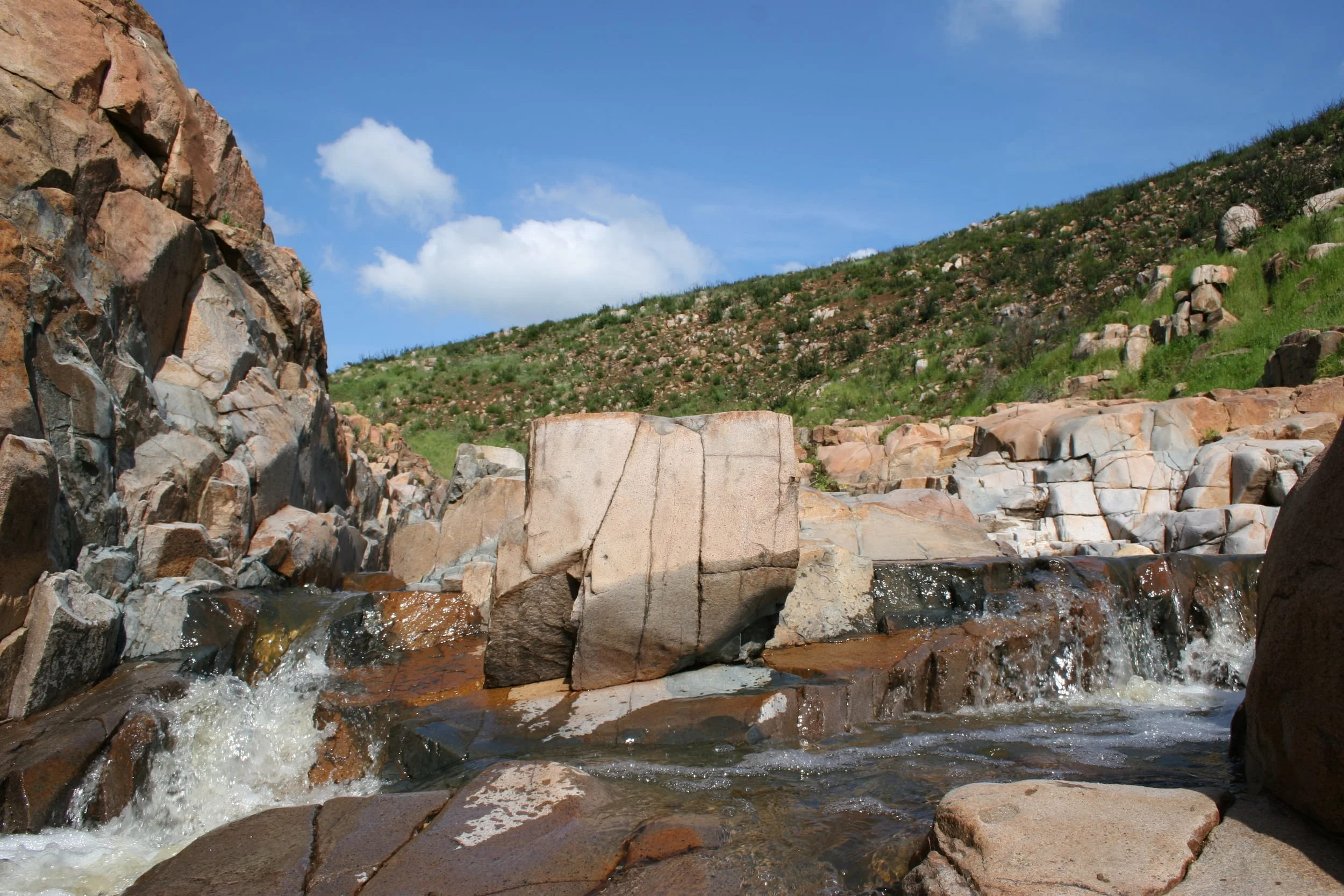
Mission Trails is a park that is known for one thing and one thing only: Cowles Mountain and that is a shame. It is a shame because, while Cowles Mountain is pretty, it is only a small portion of the 5,800 acres of open space, and it is tucked away in the Southern corner of the park. The remainder of the park is a great example of preserved open space; and a great spot to find solitude and serenity from the hustle and bustle of San Diego. Mission Trails is also a great spot to see how California used to look, as it is full of native California coastal vegetation that covers its hills and valleys; and it is a great spot to see how the seasons pass and have passed in the coastal desert plain for hundreds of years, with seasonal wildflowers and waterfalls in the winter and spring, and dry slickrock and whispering grasses in the summer and fall months. The best trail to hike in all of the park to experience everything I’ve listed above – solitude, serenity, and seasonal features is the Oak Canyon Trail; and the best time to experience it is from November to May.
Potato Chip Rock

San Diego is a spot with many great hiking trails. In fact, saying that San Diego has “many” great hiking trails sells the city short; the reality is that San Diego has a plethora of great hiking spots. I can think of no other location in the United States where the beach, canyons, hills, mountains, and deserts are all within a two hour drive; and in some cases are within a one-hour drive. San Diego is also a spot where many household names – Iron Mountain, Cowles Mountain, Torrey Pines, the Devils Punchbowl, and the Three Sisters are hiking trails. In this blog, I’ve discussed my opinions about these places and I’ve also discussed other great hiking spots; but what I will say positively about these trails and their popularity is this: they get people outside. In my experience, when people get outside, they’re more likely to learn things; they’re more likely to boost their endorphins; and they’re more likely to want to protect not only where they went, but other wilderness areas as well. So yes, these trails are popular, as I’ve discussed, but sometimes, popularity is not all bad.
Penny Pines & Garnet Peak Conditions September 2013
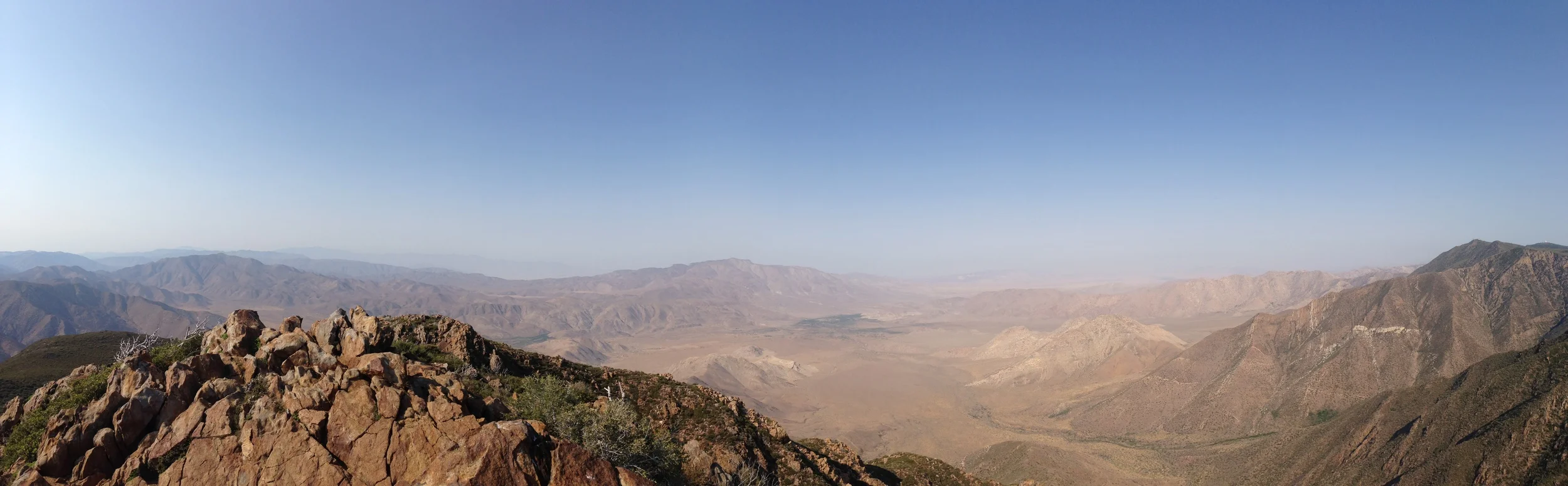
On July 5, 2013, I left work early, and headed up to Garnet Peak in the Cleveland National Forest to start my weekend with a short hike. It was a picture-perfect day with blue skies and since it was Friday afternoon, there was absolutely no one on the trail. The only downside on that day was the weather: it was hot , and the wind that rushed out of the Anza-Borrego Desert felt like an open oven. I remember feeling some of the plants and they were dry . Everything was tinder dry - not good for July in San Diego, where fire season lasts until October, or even November in drought years. Since I couldn't make it rain for the plants, I did the only thing I could: appreciated the natural beauty around me. Although I didn't know it, I was probably the last hiker to hike that area before it burned (photos here). On July 6, 2013, what became known as the Chariot Fire started, and spread through that portion of the Cleveland National Forest due to those dry conditions and high winds.
Whaley House, San Diego, California

The Whaley House. I’m not sure if there’s anything I can say about this location that hasn’t been said before. (Don’t believe me? Click here, here, here, or here for a sample of these reviews). This destination is regularly listed as one of the Top Five “Must Visit” places in San Diego. If that wasn’t strange enough, the Whaley House has received international notoriety as one of the “most haunted” locations not just in California, not just in the United States and North America, but as one of the most haunted spots in the world. That’s right: in the world! (Don’t believe me? The website for the Whaley House discusses its “haunted nature”, and solicits ghost photos! But for more info, click here, here, or here). If all of that wasn’t enough, the Whaley House has its own B-Grade horror movie! (Don’t worry, for research purposes, I watched it, and…..it was truly bad).
Mt. McGinty
Case in point: McGinty Mountain – or Mt. McGinty. Like Iron Mountain, the roundtrip distance of this hike is 4.8 miles, and the while the elevation gained is slightly less, Mt. McGinty has two advantages: more rare plants and….a lot less people. Advantage: Mt. McGinty. Moreover, Mt. McGinty also has something Iron Mountain does not: hidden mines. Advantage again: Mt. McGinty. So, if you’re interested in a peakbagging experience in San Diego county that does not involve lots of hikers, read on.
Botanical Trail, Elfin Forest Recreational Reserve
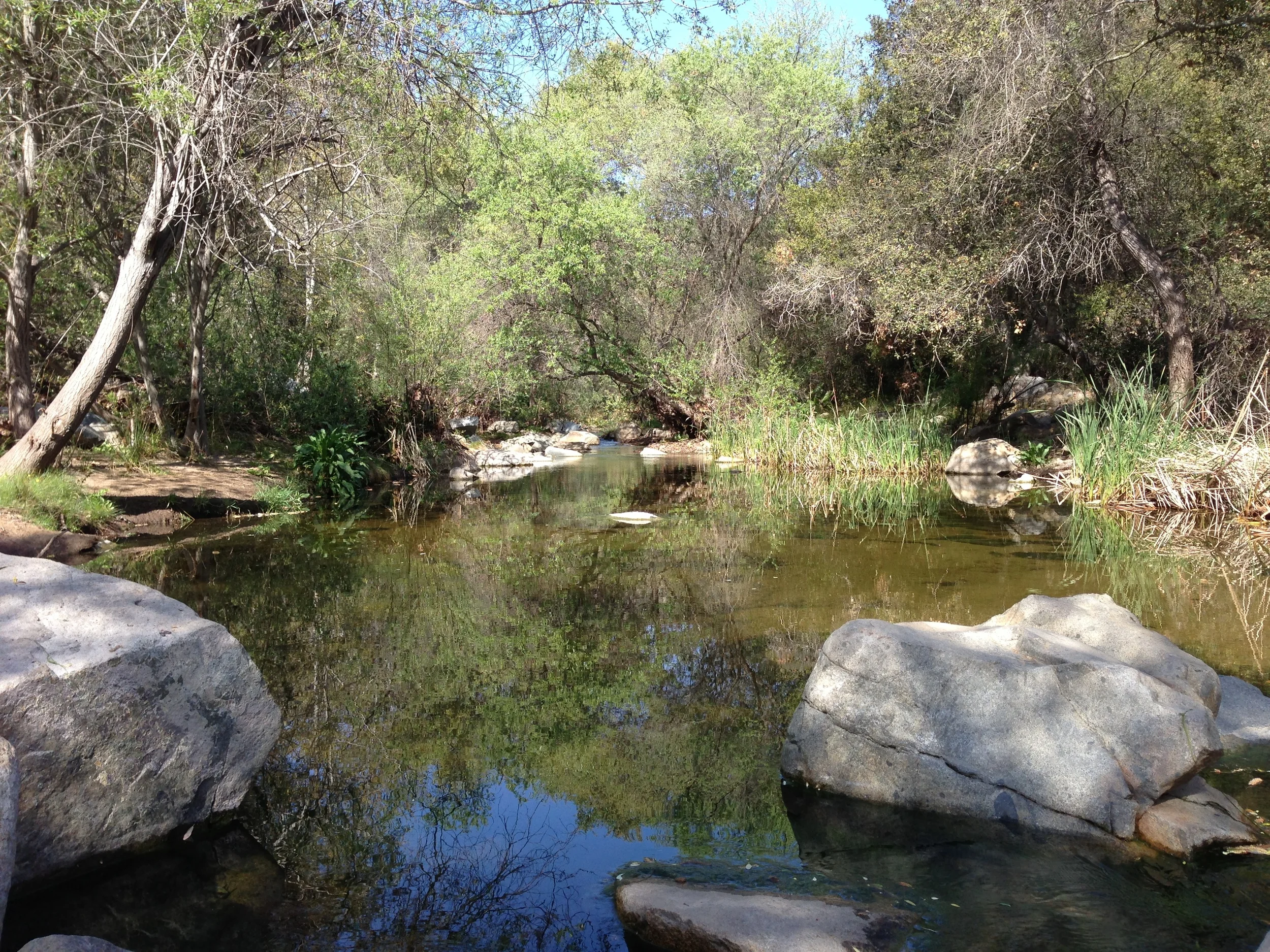
From the trailhead, the trail winds along the Escondido Creek, and there is a small area near the beginning that has great views of the creek. At this point, it is definitely worth noting that this trail is interactive – the reserve has placed markers along the trail that can be followed in one of two ways – by the paper trail guide that is present at the location, or online via this link HERE. This is a great way to learn about Southern Californian plants, and the local ecosystem of the reserve, and personally for me, I think that it’s great that this can be accessed on your smartphone while hiking – it’s a great way to be outside and learning all at the same time. After a short distance, the trail crosses over Escondido Creek, which, depending on the season, may be flowing high or low. Once you are across the creek, the trail passes through a grove of Coastal Live Oak, before heading uphill. While this section of uphill is not as steep as the nearby “Way Up Trail”, it will definitely get the blood pumping.