One of the more historic and unknown mountains in Yosemite is Clouds Rest. The mountain’s current name comes from Lafayette H. Bunnell, who was the doctor of the Mariposa Battalion which explored Yosemite Valley and Yosemite in the nineteenth century before it became a National Park. Bunnell (whose name now graces the Bunnell Cascade along the Merced River in Little Yosemite Valley) named the mountain such because when he viewed it after a snowstorm, the clouds appeared to “rest” upon the mountain. At 9,930 feet of elevation, and with a distinctive knife-like arete ridge, Clouds Rest can be viewed easily from Yosemite Valley and various other peaks in the park, particularly as it towers above nearby Tenaya Canyon.
Hickory Trail
From the border crossing at the Ambassador Bridge up past Oil Springs to the North and Niagara Falls to the East, the province of Ontario has big skies, and miles upon miles of mostly flat farmland. While it is beautiful green country, it is not a spot that most outdoor enthusiasts go to seek adventure. Yet, in this area, there are enclaves of wilderness that still exist to this day, mostly bounded by the Great Lakes that also surround this part of Canada. A prime example of one of these wilderness enclaves is Pinery Provincial Park. While Pinery Provincial Park is mostly known for the campgrounds and beaches along the shores of Lake Huron, it was established to protect one of the largest remaining stands of Oak Savannah habitat in Ontario. While the park’s beaches are impressive, a great way to experience the natural beauty of the parks is along the Hickory Trail.
Victory Beach
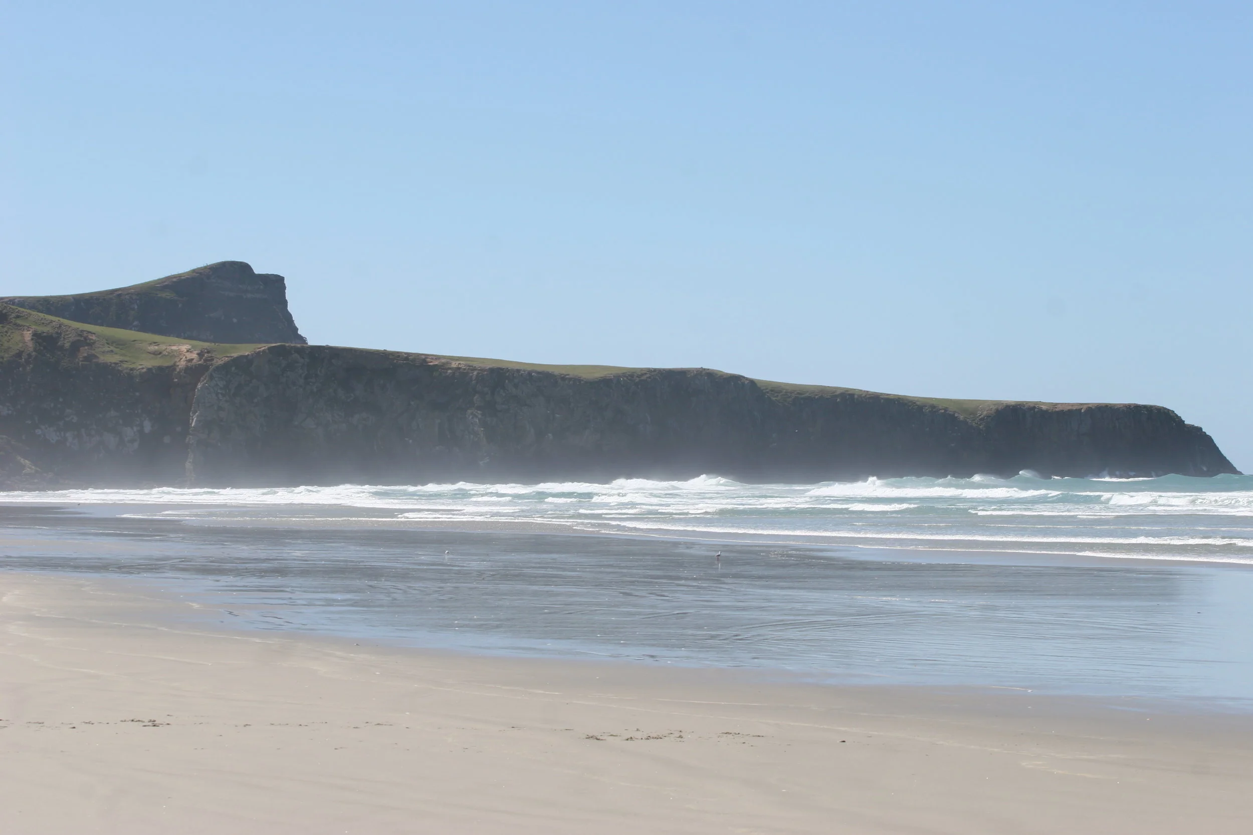
While the entirety of New Zealand has a number of pristine beaches, only one beach has a unique off-shore man-made feature and that beach is Victory Beach on the Otago Peninsula. The beach is named for the SS Victory, which, in 1861, ran aground at the end of the beach when under the control of one George Hand (who was later found to be intoxicated at the time of the wreck). While the majority of the wreck was auctioned off during the nineteenth century, and is now absent from the beach, one item remains - one of the huge flywheels of the wreck, which remains affixed about ten feet from the shore, a giant steampunk relic of a long-lost time.
Giant's Causeway
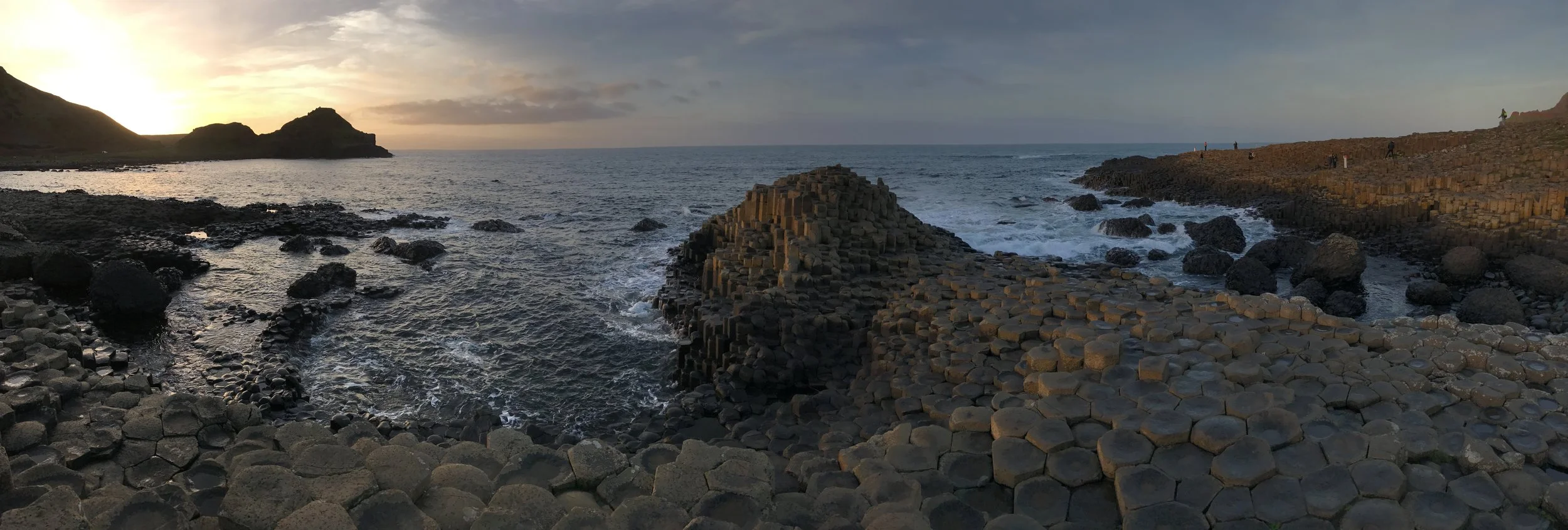
One of the most magical things about Ireland is that no matter where one goes in the country, that area is guaranteed to have a local legend of some sort. From Saints, to Holy Wells, to ghosts, monsters, the Devil himself, sprites, fairies, leprechauns and more, the land is inhabited by magical creatures and secret portals to other magical realms. And, with many places of otherworldly scenery, even if you are a non-believer, it is easy to see how such myths, legends, and stories came about. Out of all of these places, however, there is only one spot where one can visit where two giants battled, or depending on the account, where one giant tricked another, and that is the Giant’s Causeway in Northern Ireland.
Lone Pine Lake
At 14,505 feet, Mount Whitney is the tallest mountain in the continental United States, and one of the most popular spots to hike and climb. In addition to these things, it also has a number of high alpine lakes located nearby (such as the Meysan Lakes), and a number of lakes located along the trail to the summit - such as Mirror, Consultation - and Lone Pine Lake. While Lone Pine Lake is technically not on the trail to the summit, as it is off a short spur trail, it is a great short hike for beginner backpackers and hikers, and for those parties looking to take more than one day to summit Mount Whitney.
Pancake Rocks
From its northern tip to its southern stretches, the South Island of New Zealand has a number of unique geologic features like the Moreaki Boulders. While some of these locations require a bit of commitment to see, other features like the Pancake Rocks on the west coast of New Zealand are easily accessible. Further, as a whole, the west coast of New Zealand’s South Island is an area that, while it is isn't hidden, is wild as a whole. As a start, the west coast is one of the rainiest portions in the entirety of the island, with storms commonly coming off the Tasman Sea. It is also an area that in places, resembles a more tropical locale with pristine beaches, and has many sub-tropical rainforests that are in part, are protected in Paparoa National Park.
Hall of Mosses
While there are three temperate rainforests inside the boundaries of Olympic National Park (Hoh, Quinault, and Queets), the most popular and well-known is the Hoh Rainforest. In addition to its notoriety, the Hoh Rainforest is also the only one of the three to be named a World Heritage Site and a Biosphere Reserve by UNESCO. Before it received this type of recognition, however, the Hoh itself was one of the main reasons for establishing Olympic National Park, as the park itself was created to preserve “the finest example of primeval forest…”. Located on the slopes of the western slopes of the Olympic Mountains, the Hoh is also a spot that receives a great deal of precipitation, averaging over fourteen feet of rain per year. All of this rain has encouraged the growth of tall stands of sitka spruces and western hemlocks, and many other plants throughout the forest. While there are many trails that explore the Hoh Rainforest, the easiest and most accessible introduction to the region is the Hall of Mosses trail.


